
DJI Mavic 3 Multispectral Specs
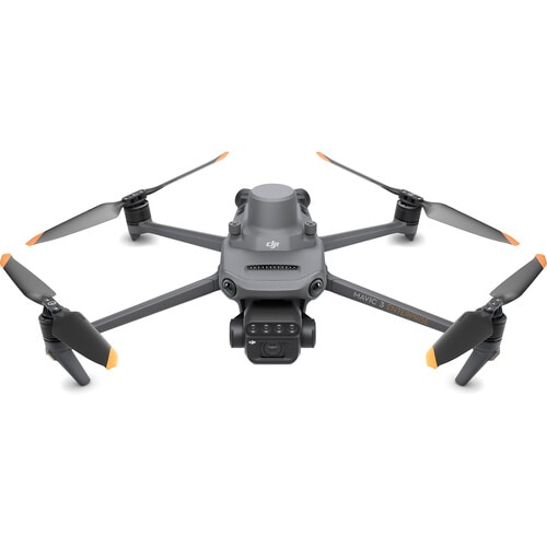
DJI Mavic 3 Multispectral (M3M) is a precision agriculture survey drone that combines a high-resolution RGB camera and a 4-band multispectral camera in a single unit. It is designed for fast, accurate crop health mapping and vegetation index analysis such as NDVI, meeting the needs of modern farmers, mapping service providers, and agricultural research.
20 MP RGB camera for high-resolution imaging and aerial photo mapping (photogrammetry)
4-band multispectral camera with 5 MP per band, covering the Green (560 nm), Red (650 nm), Red Edge (730 nm), and Near-Infrared (860 nm) wavelengths, dedicated to crop health analysis
Supports vegetation index calculations such as NDVI, NDRE, and GNDVI to assess crop vigor and detect plant stress in detail
Up to 43 min flight time (in windless conditions), covering a large survey area per flight and reducing the number of flights and time spent in the field
Supports RTK for centimeter-level positioning, with horizontal hovering accuracy of ±0.1 m when using RTK, ideal for high-precision mapping
Built-in sunlight sensor records solar irradiance in real time, compensating for lighting so multispectral data stays consistently accurate in all lighting conditions
Video transmission range of up to 15 km (FCC standard) and wind resistance up to 12 m/s for stable operation in outdoor environments
Takeoff weight of approx. 1,050 g, easy to carry and deploy in the field
What Is the DJI Mavic 3 Multispectral Suited For?
With its dual RGB and multispectral cameras, plus RTK and a sunlight sensor, the M3M is a core tool for precision agriculture and many kinds of crop field management.
Precision Agriculture
Create crop health maps and NDVI/NDRE vegetation index maps to systematically analyze field conditions, helping farmers make decisions based on real data, increase yields, and reduce costs.
Crop Health Monitoring and Anomaly Detection
Detect plant stress, nutrient deficiencies, plant diseases, and pest outbreaks at an early stage, before they are visible to the naked eye, enabling timely action and limiting damage.
Variable-Rate Water and Fertilizer Management
Use multispectral data to plan irrigation and fertilization that varies by area (variable rate), applying resources only where needed to reduce fertilizer and water waste while caring for the environment.
Surveying, Mapping, and Agricultural Research
Ideal for survey service providers, research institutes, and agricultural agencies that need high-resolution geospatial data to analyze yields, assess areas, and monitor long-term changes in crop fields.
Key Features of DJI Mavic 3 Multispectral
Dual RGB + Multispectral camera system Combines a 20 MP camera and a 4-band multispectral camera in one unit, capturing both true-color imagery and crop health data simultaneously in a single flight
Built-in Sunlight Sensor Compensates for sunlight intensity in real time, so the data is accurate and can be reliably compared over time
Centimeter-level accuracy with RTK Reduces ground control point (GCP) placement and improves the accuracy of the resulting maps
Flight time of up to 43 min Covers a large area per flight, boosting productivity and reducing time in the field
Integrates with DJI processing software Works with DJI Terra and agricultural analysis tools to create vegetation index maps and reports end to end
To learn more about the basics of what a drone is and the benefits of drones, read our related articles, or contact the DJI 13 Store team for advice and a quote.