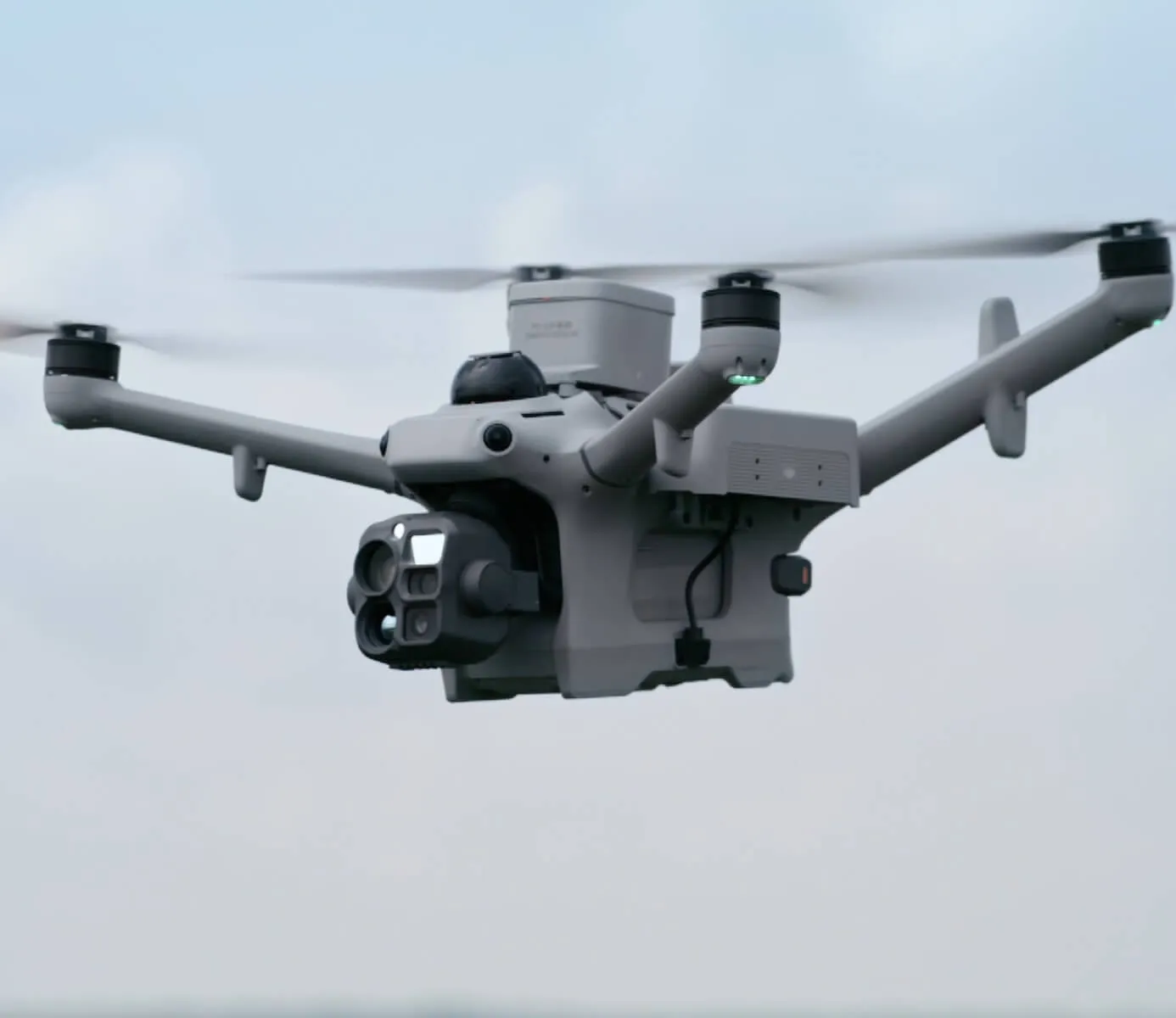
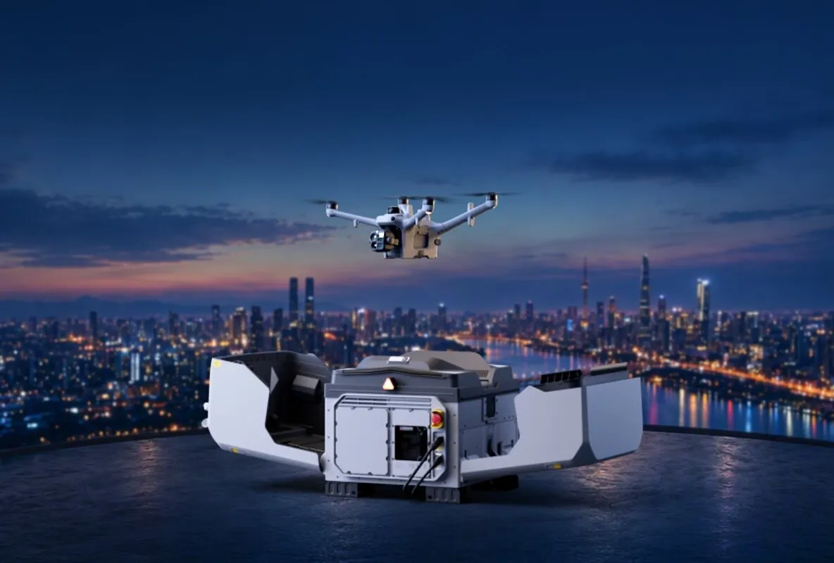
Dock รุ่นแรกของ DJI ที่สลับแบตเตอรี่อัตโนมัติ

DJI Dock 4

Always There, Always Ready

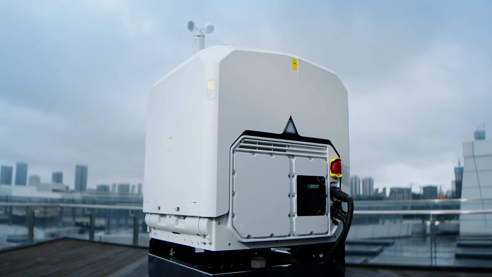
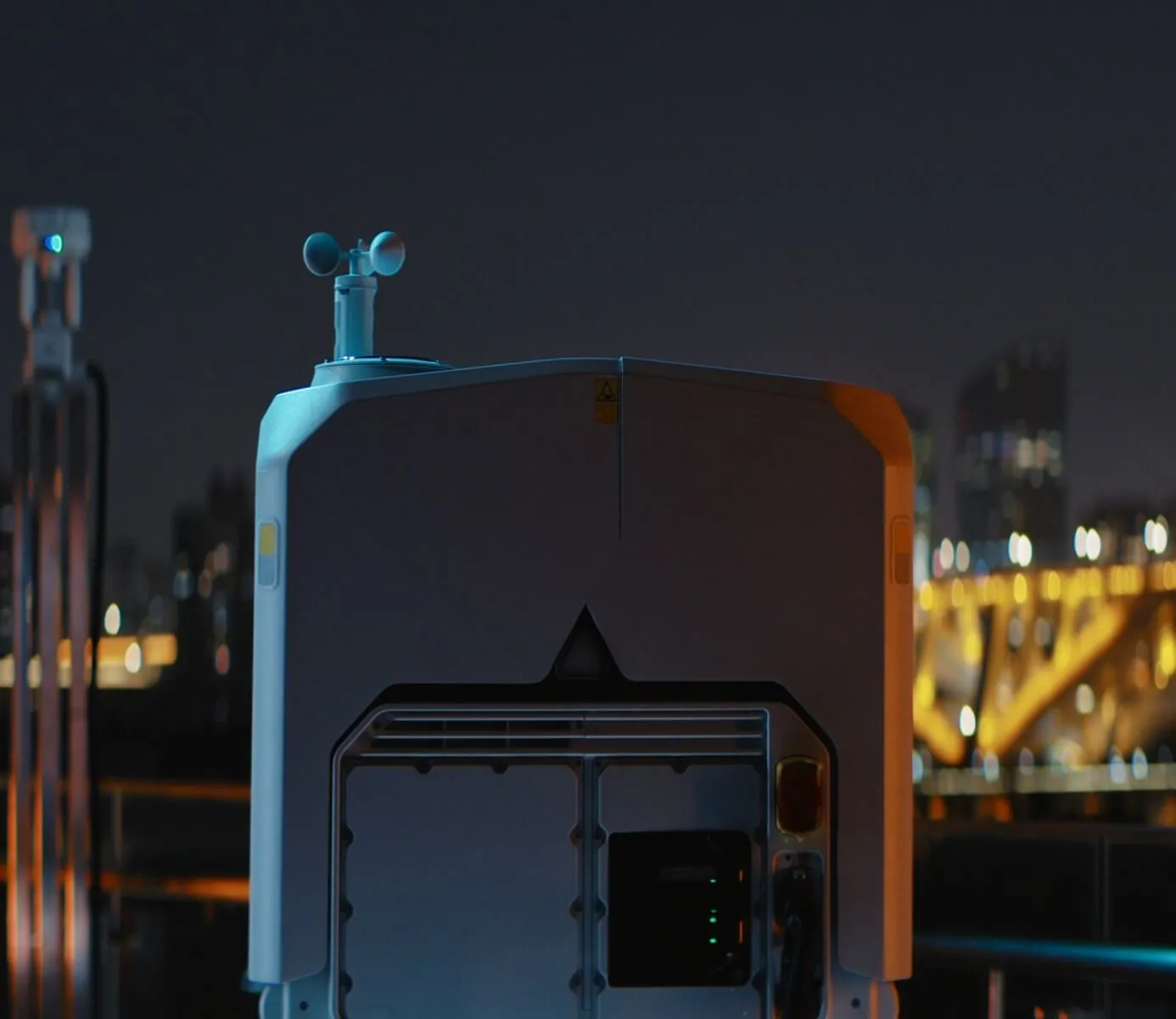
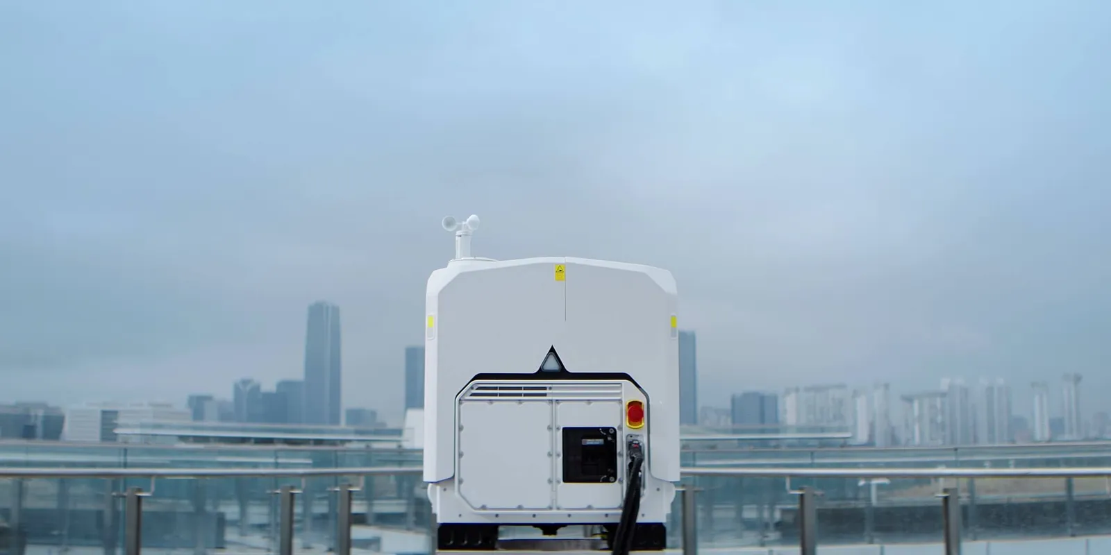
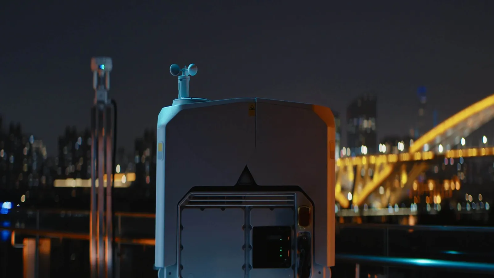
DJI Dock 4 ติดตั้งบนดาดฟ้าอาคาร

25 วิ

สลับแบตเตอรี่อัตโนมัติ 1

59 นาที

เวลาบินต่อเที่ยว 5

21 ม./วิ

ความเร็วสูงสุดไปยังจุดเกิดเหตุ 4

-40~50°C

อุณหภูมิใช้งาน

IP56

กันน้ำ-กันฝุ่น

17 ประเภท

AI ตรวจจับวัตถุบนโดรน

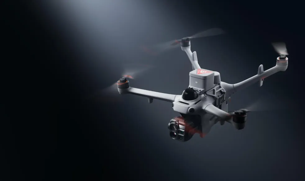
DJI Dock 4 สลับแบตเตอรี่ได้ใน 25 วินาที 1 ปฏิบัติการอัตโนมัติได้ตลอด 24 ชม. ทั้งงานเร่งด่วนและงานต่อเนื่อง ใช้คู่กับโดรน DJI Matrice 5TD ที่มีกล้องมุมกว้าง กล้องอินฟราเรด เรดาร์ mmWave, LiDAR และ AI ตรวจจับวัตถุได้ 17 ประเภท พร้อม DJI O4 Ground Station 2 ที่ช่วยให้ติดตั้งในพื้นที่ซับซ้อนได้ และเวิร์กโฟลว์ที่ขับเคลื่อนด้วย AI จาก DJI FlightHub 2 3

Rapid Response
พร้อมบินในไม่กี่วินาที ตอบสนองเหตุได้ทันที

พร้อมบินในไม่กี่วินาที ตอบสนองเหตุได้ทันที

ขึ้นบินทันทีที่สั่ง ถึงก่อนทีมภาคพื้น

โดรนออกบินทันทีที่ฝา Dock เปิด บินไปยังจุดเกิดเหตุด้วยความเร็วสูงสุด 21 ม./วิ 4 ถึงก่อนทีมภาคพื้นและส่งภาพสดได้ทันที

ออกบินทันที

ออกบินทันที

เมื่อสั่งงาน โดรนขึ้นบินได้ทันทีโดยไม่ต้องมีนักบินอยู่หน้างาน เหตุฉุกเฉินตอนกลางคืนหรือวันหยุดก็ตอบสนองได้ในไม่กี่วินาที
ถึงที่เกิดเหตุด้วย 21 ม./วิ

ถึงที่เกิดเหตุด้วย 21 ม./วิ

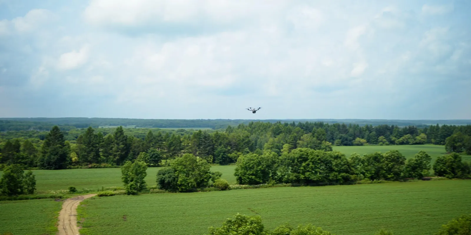
ความเร็วสูงสุด 21 ม./วิ 4 บินตรงไปยังจุดเกิดเหตุโดยไม่ติดสภาพการจราจร ประหยัดเวลาในช่วงที่สำคัญที่สุด

สลับแบต ส่งต่อภารกิจ ทำงานต่อเนื่อง

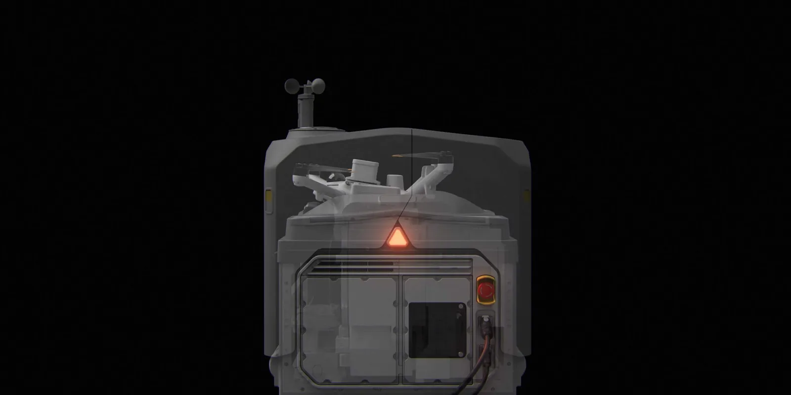
สำหรับงานต่อเนื่องอย่างการตอบสนองเหตุฉุกเฉิน Dock สลับแบตเตอรี่อัตโนมัติเสร็จใน 25 วินาที 1 ลดเวลาระหว่างเที่ยวบินจากการชาร์จ 30 นาทีเหลือเพียงไม่กี่วินาที
สลับแบตเตอรี่ใน 25 วินาที

สลับแบตเตอรี่ใน 25 วินาที

สลับแบตเตอรี่อัตโนมัติเต็มระบบใน 25 วินาที 1 และส่งข้อมูลจากเที่ยวบินก่อนหน้ากลับมาให้อัตโนมัติระหว่างสลับ
บินได้นานขึ้น

บินได้นานขึ้น

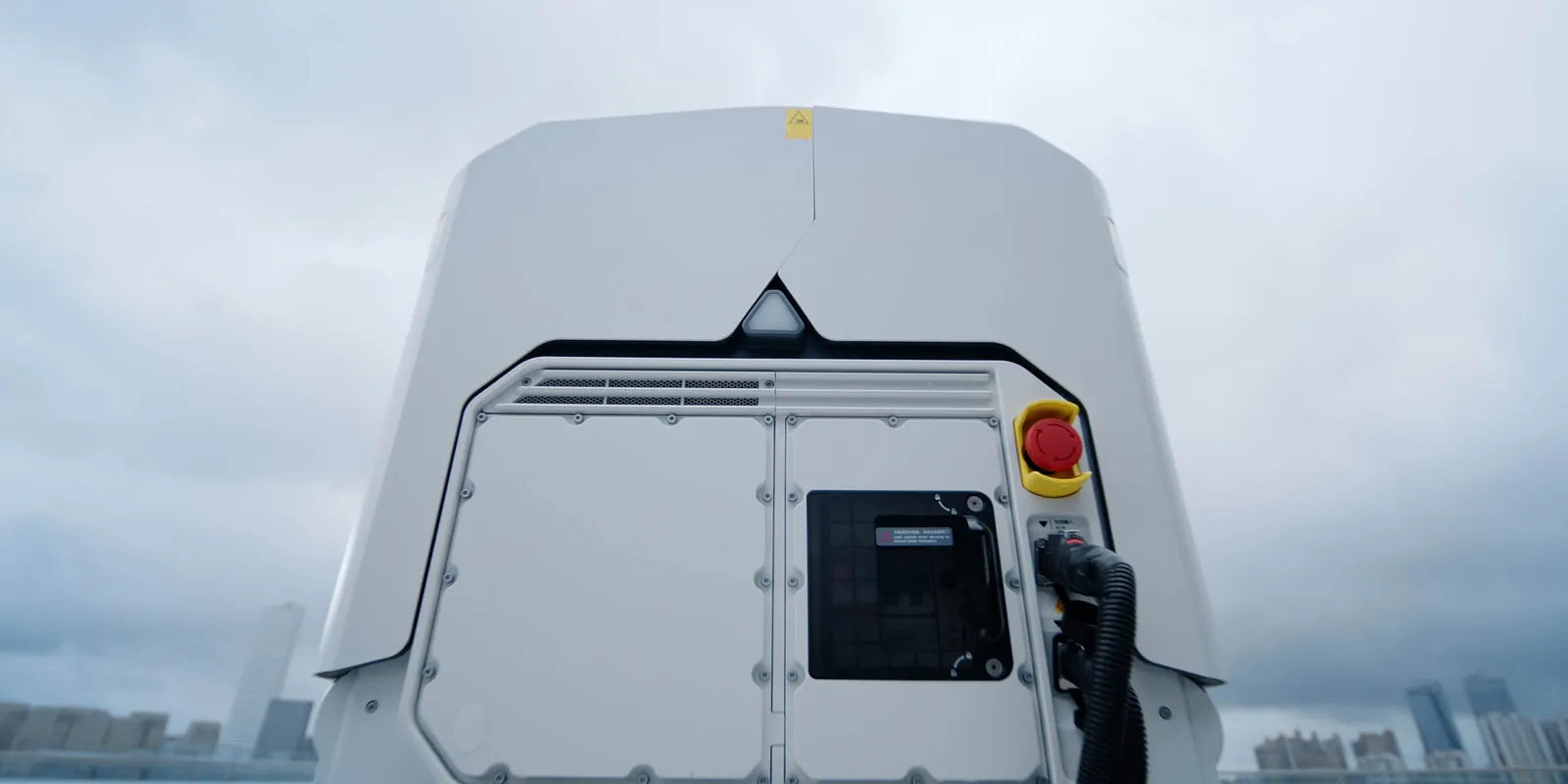
บินได้สูงสุด 59 นาทีต่อเที่ยว 5 ครอบคลุมพื้นที่ได้มากขึ้นในการขึ้นบินครั้งเดียว
ทำงานได้ทุกอุณหภูมิ

ทำงานได้ทุกอุณหภูมิ

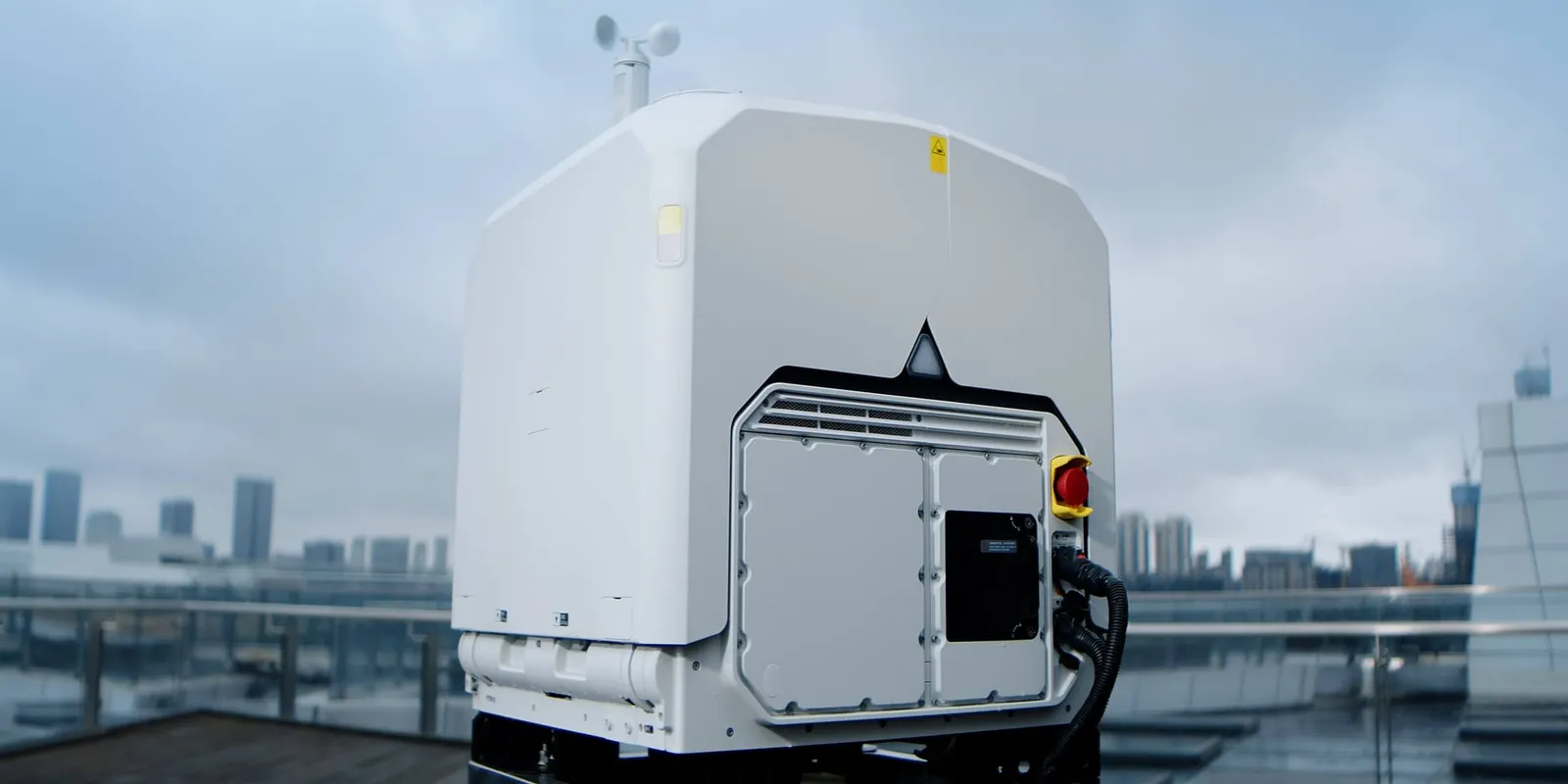
ทำงานได้ตั้งแต่ -40° ถึง 50°C อุ่นแบตเตอรี่อัตโนมัติเมื่ออากาศเย็น และมีระบบปรับอากาศเมื่ออากาศร้อน
ส่งต่อภารกิจระหว่างโดรน

ส่งต่อภารกิจระหว่างโดรน

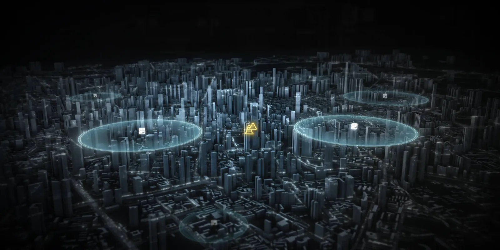
โดรน 2 ลำในโปรเจกต์เดียวกันสลับกันบินได้อัตโนมัติ ลำหนึ่งบิน อีกลำสแตนด์บาย เห็นสถานการณ์ต่อเนื่องไม่สะดุดระหว่างเหตุฉุกเฉิน

ภาพสดจากหน้างาน สั่งการจากระยะไกลได้แม่นยำ

ด้วยภาพสดหน่วงต่ำและการส่งข้อมูลความเร็วสูง ผู้บัญชาการเห็นหน้างานแบบเรียลไทม์และตัดสินใจได้จากนอกพื้นที่
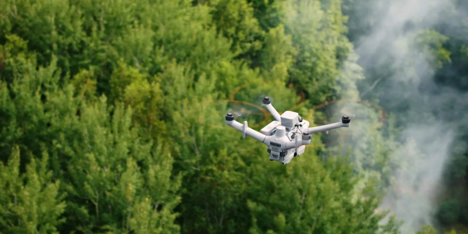
ภาพสดหน่วงต่ำ

ภาพสดหน่วงต่ำ

โครงข่ายส่งภาพเฉพาะ ลดความหน่วงจากโดรนถึงคลาวด์เหลือประมาณ 160 มิลลิวินาที 6 ต่ำลงราว 43% จากรุ่นก่อน ภาพสดลื่นขึ้น
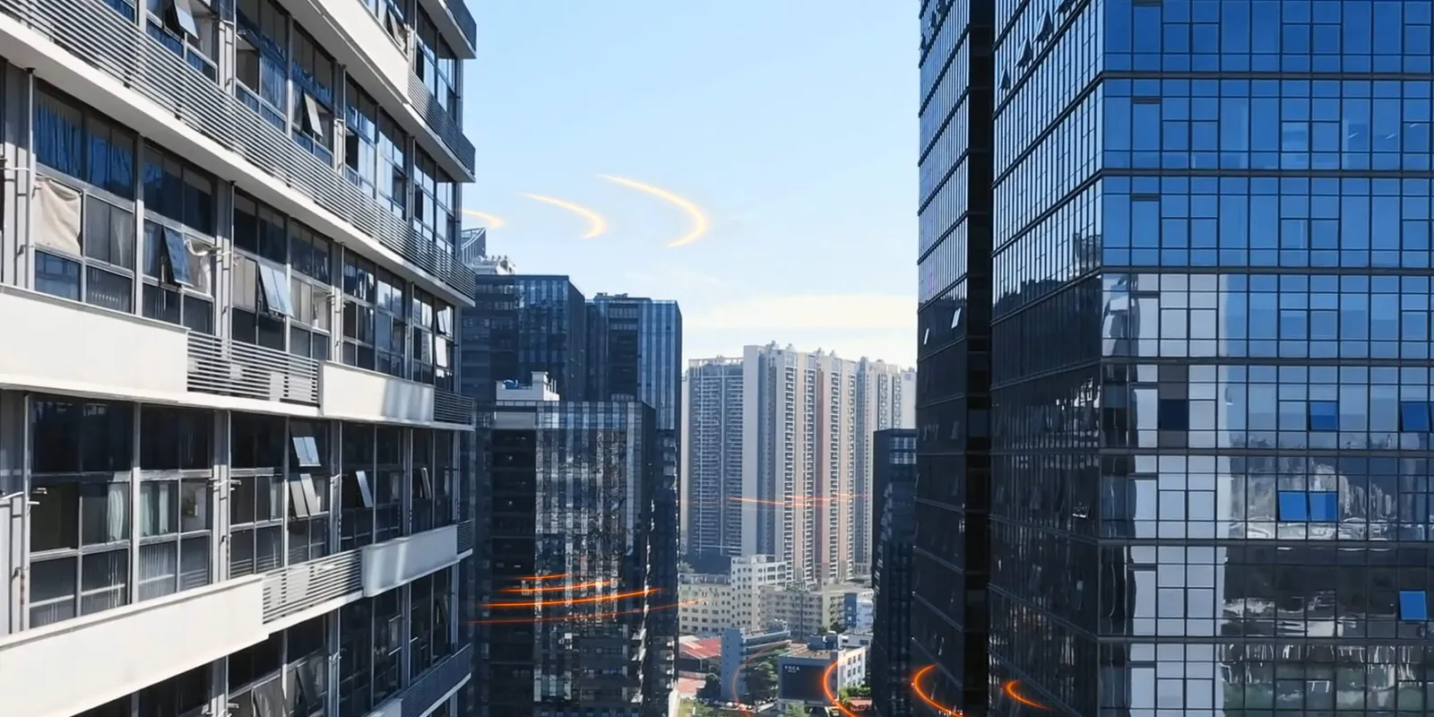
ส่งสัญญาณทนการรบกวน

ส่งสัญญาณทนการรบกวน

โมดูล 4G คู่ 7 การส่งสัญญาณย่าน sub2G 8 และ O4 Ground Station ที่ติดตั้งบนจุดสูง ให้สัญญาณเสถียรในพื้นที่มีสิ่งกีดขวาง
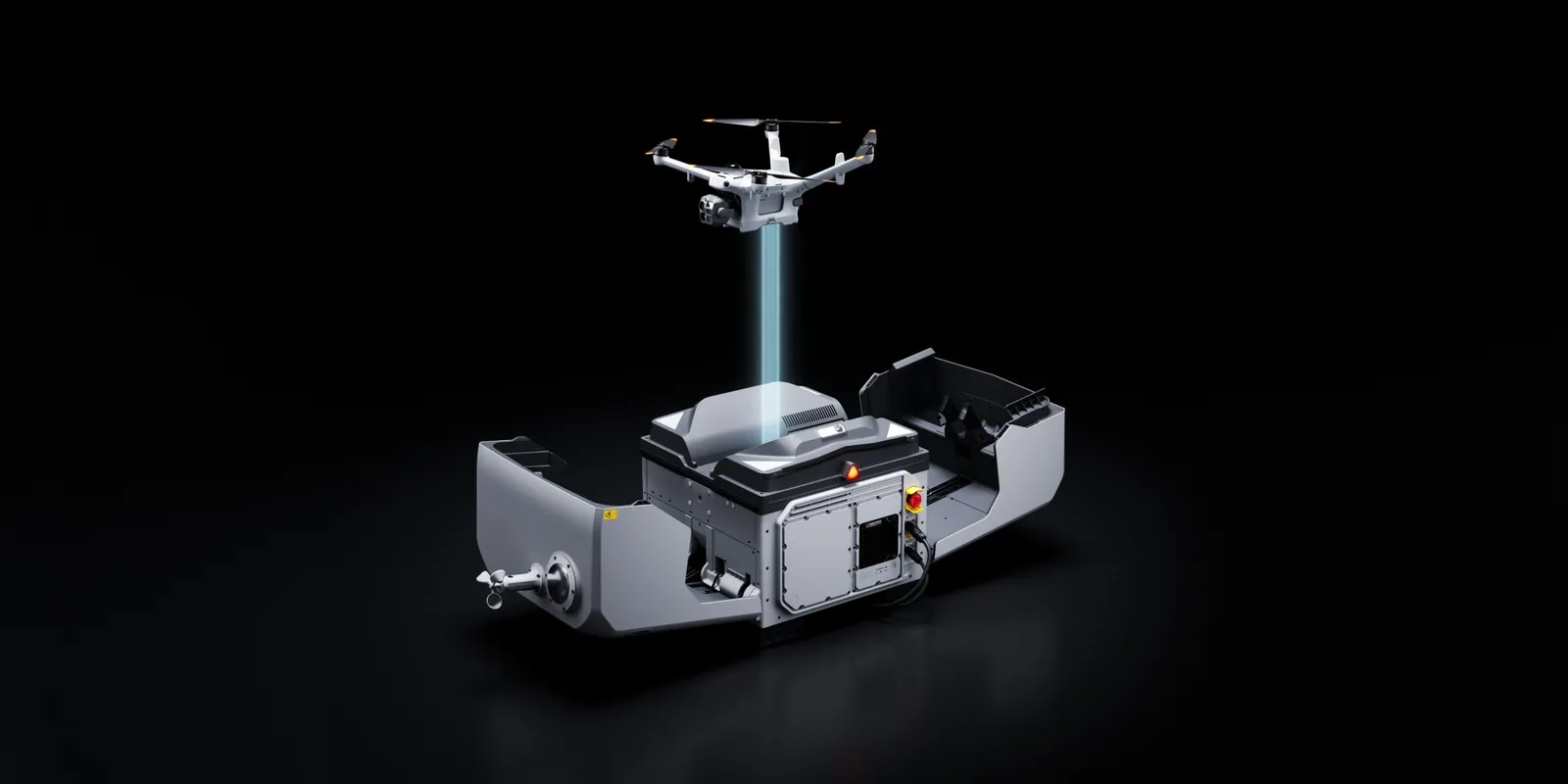
โอนข้อมูลเร็ว

โอนข้อมูลเร็ว

ระหว่างสลับแบตเตอรี่ โดรนส่งข้อมูลการบินให้ Dock ผ่าน Wi-Fi ความเร็วสูง เฉลี่ย 80MB/s 9

Multi-Sensor
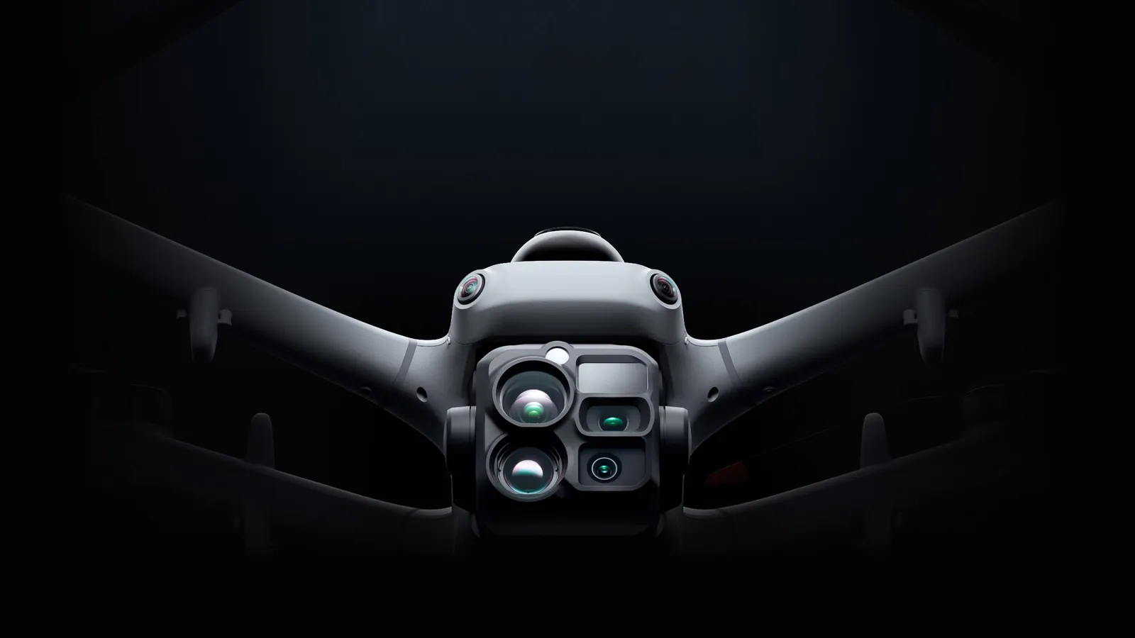
เซนเซอร์หลายตัว ใช้งานได้หลากหลายขึ้น

เซนเซอร์หลายตัว ใช้งานได้หลากหลายขึ้น

ใกล้หรือไกล กลางวันหรือกลางคืน

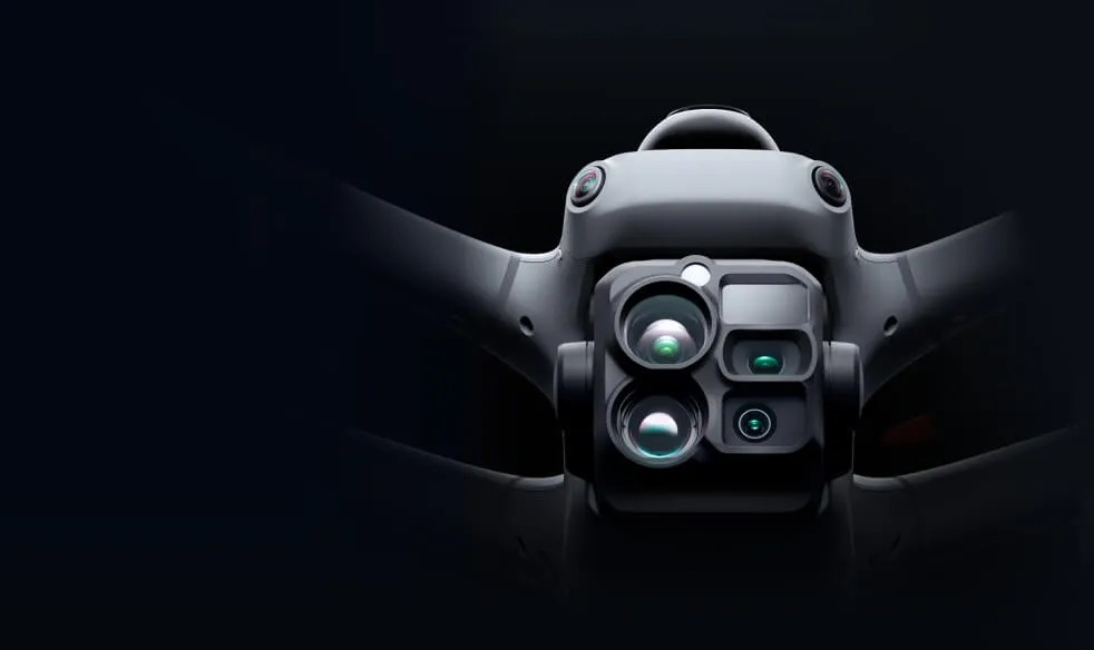
Matrice 5TD รวมกล้องเทเล กล้องอินฟราเรด เลเซอร์วัดระยะ และการมองเห็นกลางคืนแบบภาพสี พร้อมความแม่นยำงานสำรวจทางอากาศสูงสุด 10 ซม. ที่ 12MP 10 งานตรวจตอนกลางวัน รักษาความปลอดภัยตอนกลางคืน และงานสำรวจ ทำได้ด้วยโดรนลำเดียวโดยไม่ต้องเปลี่ยนเครื่อง เพิ่มความคุ้มค่าของอุปกรณ์ได้ 50% 24
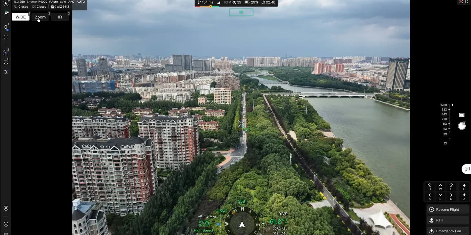
เทเลซูม 11 เท่า

เทเลซูม 11 เท่า

ทางยาวโฟกัสเทียบเท่า 252 มม. อ่านรายละเอียดป้ายได้จากระยะ 400 ม. 11 และเห็นความผิดปกติระดับน็อตและสลักที่ระยะ 100 ม. สำหรับงานตรวจสายไฟฟ้า
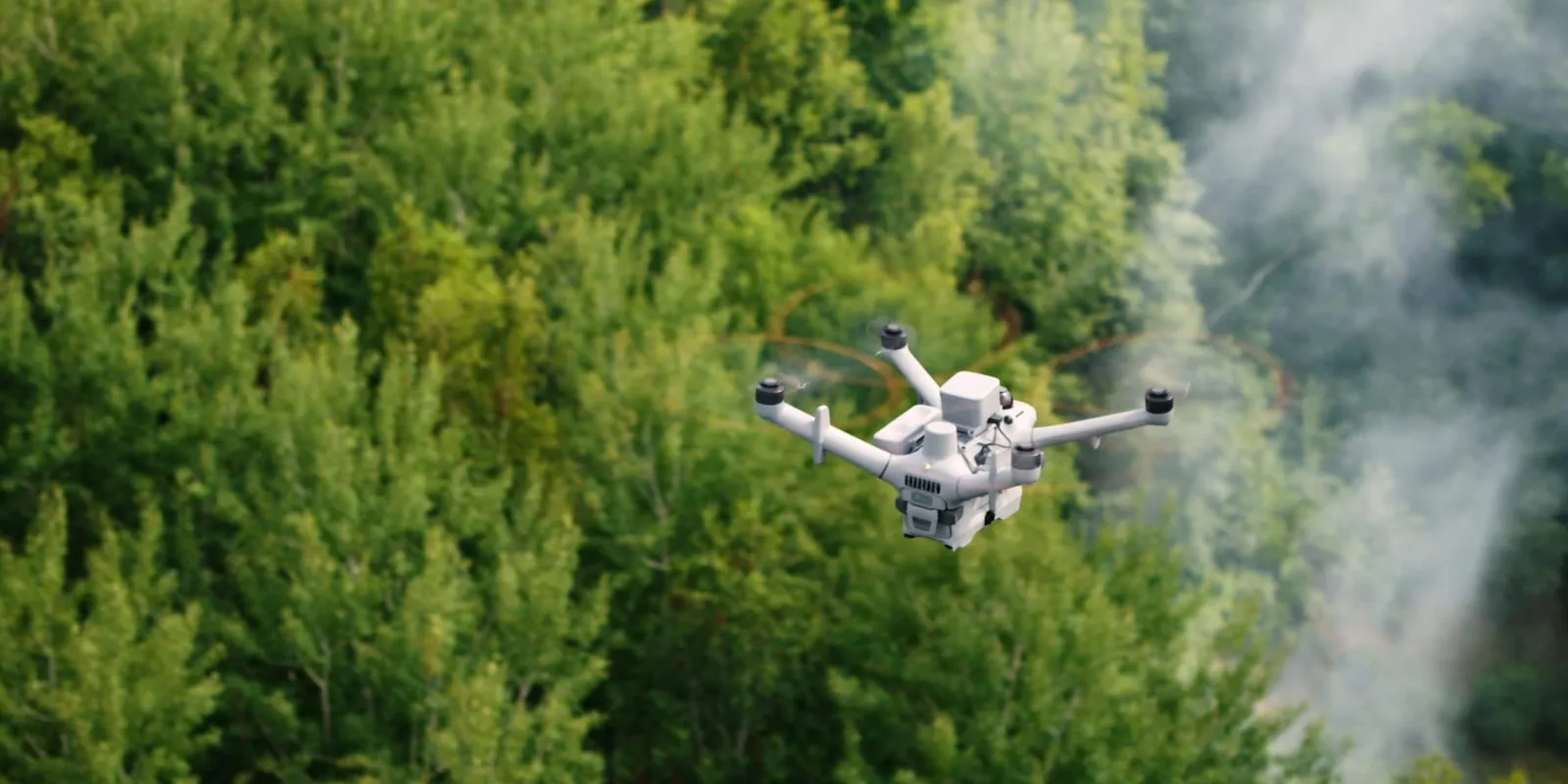
กล้องอินฟราเรด

กล้องอินฟราเรด

ความละเอียด 1280 × 1024 หรือ 2560 × 2048 ในโหมด UHR เห็นจุดร้อนผิดปกติและลูกถ้วยที่เสียหาย บันทึก 2K และซูม 32 เท่าสำหรับเป้าหมายตอนกลางคืน
โหมดภาพผสาน (Fusion)

โหมดภาพผสาน (Fusion)

รวมภาพกล้องปกติและอินฟราเรดไว้ในภาพเดียว เลือกแบบเน้นขอบหรือแบบซ้อนทับ เห็นทั้งโครงสร้างและการกระจายความร้อนโดยไม่ต้องสลับกล้อง
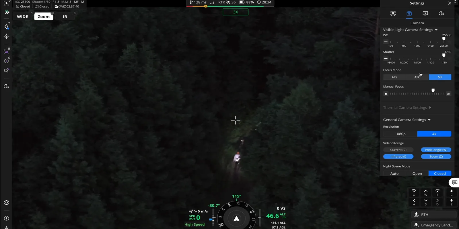
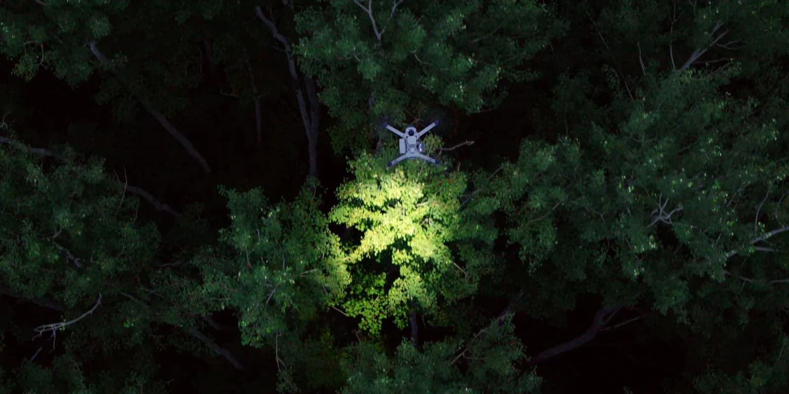
มองเห็นกลางคืนชัดขึ้น

มองเห็นกลางคืนชัดขึ้น

การมองเห็นกลางคืนแบบภาพสี 4K อัตราเฟรมสูง ถ่ายภาพสีตอนกลางคืนได้โดยไม่ต้องเปิดไฟส่อง 16 และใช้คู่กับไฟ NIR สำหรับภาพขาวดำกลางคืนได้
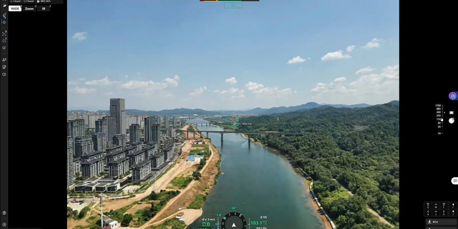
เลเซอร์วัดระยะ 3 กม.

เลเซอร์วัดระยะ 3 กม.

แสดงระยะทางและพิกัด PinPoint ซ้อนบนภาพสด สำหรับงานตรวจสายไฟ กู้ภัย หรือประเมินไฟป่า

ติดอุปกรณ์ได้มากขึ้น ยืดหยุ่นขึ้น

Matrice 5TD รับน้ำหนักอุปกรณ์เสริมได้สูงสุด 450 ก. มีจุดติดตั้ง PSDK ด้านข้างและด้านบนที่ใช้พร้อมกันได้ เลือกผสมอุปกรณ์ 12 ให้ตรงกับงาน
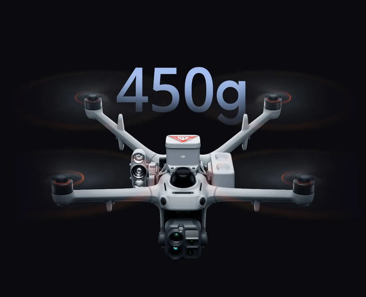
รับน้ำหนักสูงสุด 450 ก.

รับน้ำหนักสูงสุด 450 ก.

มีจุดติดตั้ง 3 จุด 13 รับน้ำหนักใช้งานได้ถึง 450 ก. ให้แสงสว่าง ประกาศเสียง และความปลอดภัยภาคพื้นได้ในเที่ยวบินเดียว
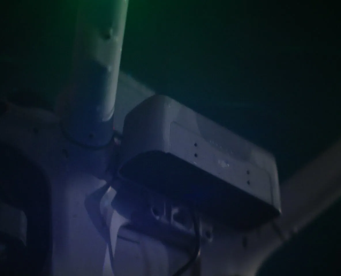
ลำโพง + ไฟส่อง + ร่มชูชีพ

ลำโพง + ไฟส่อง + ร่มชูชีพ

ติดลำโพง ไฟส่อง 25 และร่มชูชีพพร้อมกัน ประกาศเสียงจากอากาศและให้แสงหลายระดับระหว่างค้นหาตอนกลางคืน ช่วยให้ทีมภาคพื้นปลอดภัย
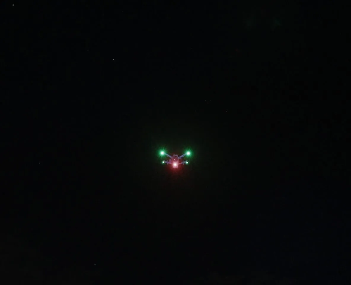
ไฟเตือนในตัว ปรับแต่งได้

ไฟเตือนในตัว ปรับแต่งได้

ไฟเตือนในตัวเลือกสีและรูปแบบการกะพริบได้ ไม่ต้องติดตั้งเพิ่ม

Robust Protection
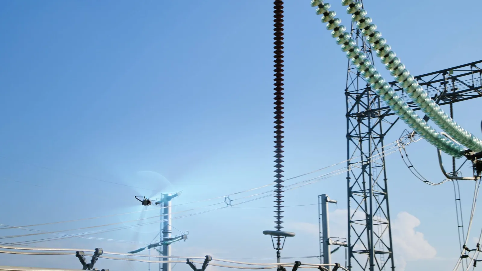
ระบบป้องกันรอบด้าน บินได้อย่างมั่นใจ

ระบบป้องกันรอบด้าน บินได้อย่างมั่นใจ

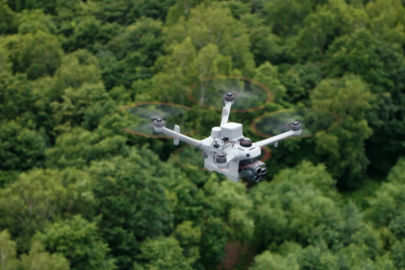
บินปลอดภัยแม้ในพื้นที่ซับซ้อน

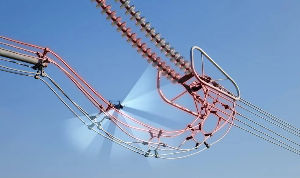
เรดาร์ mmWave 3 ทิศทาง LiDAR แบบหมุน และระบบมองเห็น 6 ทิศทาง ทำงานร่วมกัน ให้ Matrice 5TD ตรวจจับสิ่งกีดขวางได้แม่นยำ 14 แม้ในสถานีไฟฟ้าย่อยที่มีอุปกรณ์มีไฟฟ้าหนาแน่น หรือรอบสายจำหน่ายที่ไขว้กัน
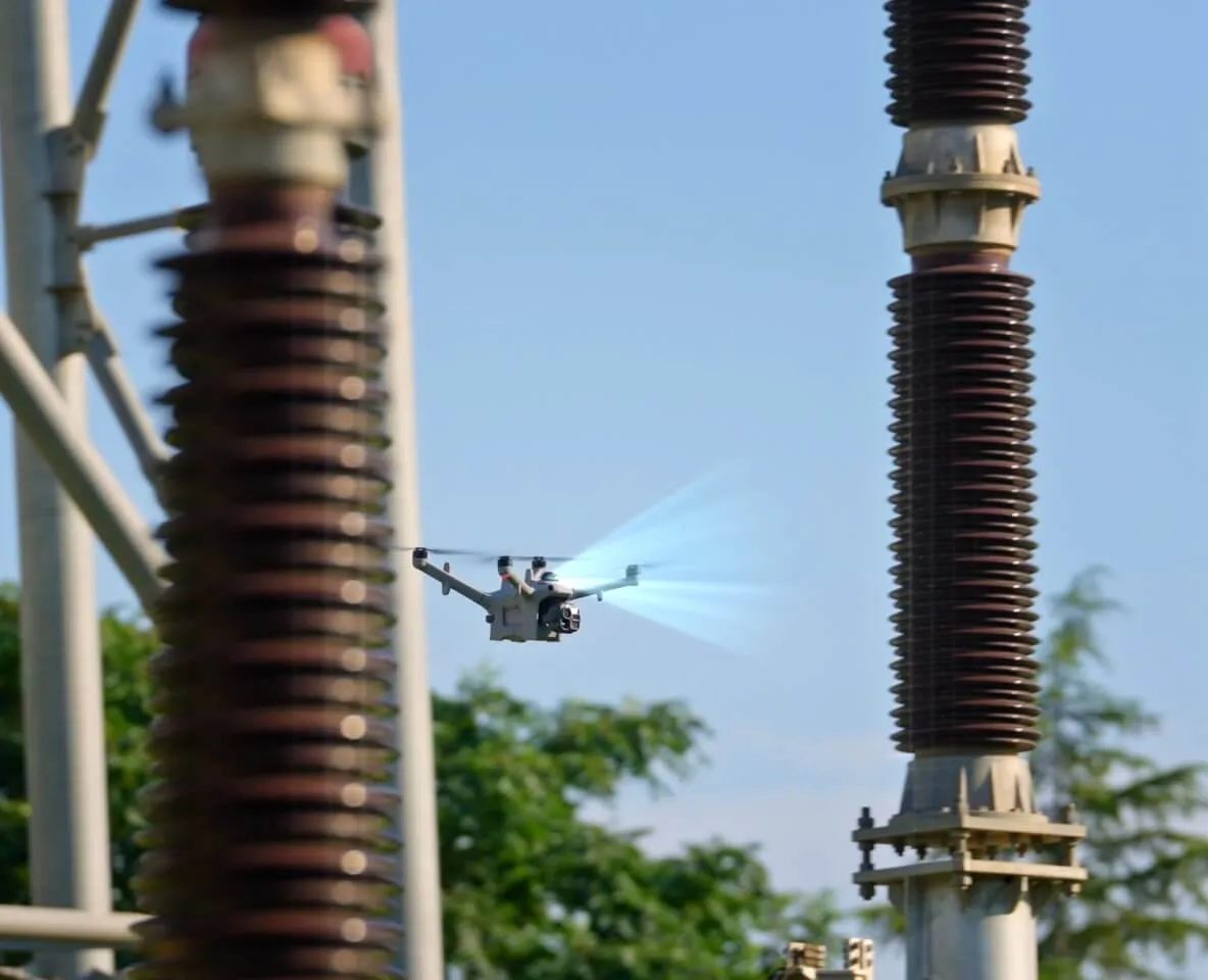
ตรวจจับได้ถึงระดับสายไฟ

ตรวจจับได้ถึงระดับสายไฟ

LiDAR แบบหมุน เรดาร์ mmWave 14 และเซนเซอร์ฟิชอายแบบภาพสีในที่แสงน้อย ตรวจจับสิ่งกีดขวางเล็กบางอย่างสายไฟได้แม้ตอนกลางคืน 15
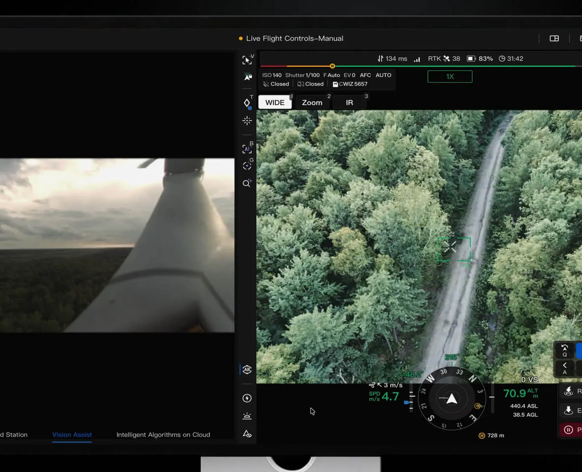
ตรวจจับ 6 ทิศทางแบบภาพสี

ตรวจจับ 6 ทิศทางแบบภาพสี

ระบบตรวจจับ 6 ทิศทางทำงานร่วมกับเซนเซอร์ฟิชอายความละเอียดสูง 6 ตัว ตรวจจับสิ่งกีดขวางได้ 15 แม้ใต้แสงไฟในเมืองตอนกลางคืน

ติดตั้งได้ยืดหยุ่นในพื้นที่ซับซ้อน

ด้วย LiDAR และ Visual SLAM ของ Matrice 5TD อัลกอริทึมกันการรบกวนและกันสัญญาณปลอม รวมกับ DJI O4 Ground Station 2 ทำให้ติดตั้ง DJI Dock 4 ใกล้อาคารสูงได้ 17 หรือบนรถ (เร็ว ๆ นี้) 18
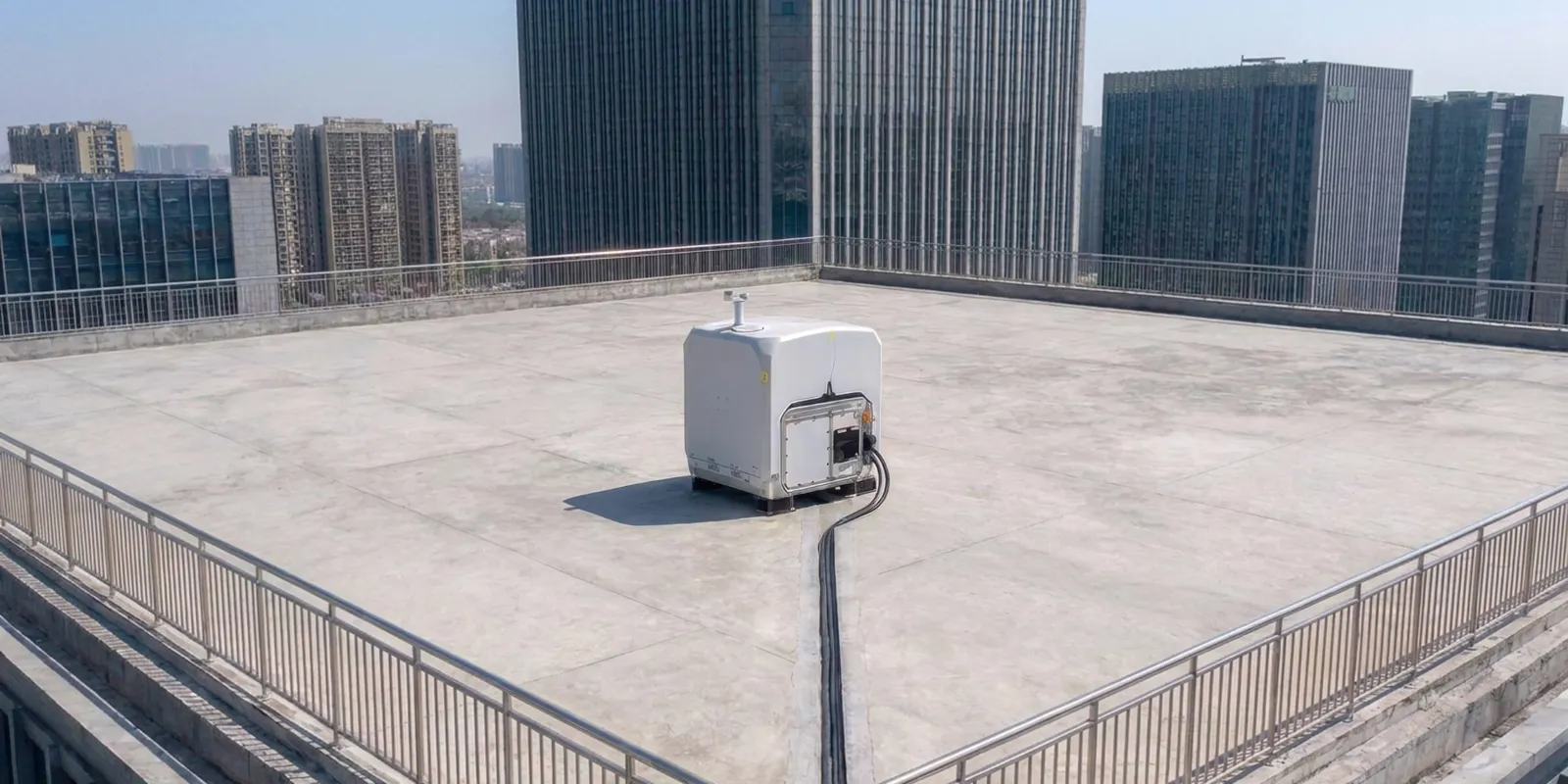
ใกล้อาคารสูง

ใกล้อาคารสูง

ติดตั้ง O4 Ground Station บนดาดฟ้าเพื่อให้สัญญาณดีขึ้น ทำให้ติดตั้ง Dock 4 ใกล้อาคารสูงหรือตามแนวกำแพงสถานีไฟฟ้าได้ 17
ติดตั้งบนรถ (เร็ว ๆ นี้)

ติดตั้งบนรถ (เร็ว ๆ นี้)

โดรนขึ้นบินขณะรถจอด และลงจอดที่จุดใหม่หลังรถเคลื่อนย้ายแล้ว 18

สลับสถานีภาคพื้นอัตโนมัติ

สลับสถานีภาคพื้นอัตโนมัติ

O4 Ground Station รองรับการสลับหลายสถานี โดรนเปลี่ยนไปใช้สถานีที่ใกล้กว่าได้อย่างราบรื่น ลดจุดอับสัญญาณ

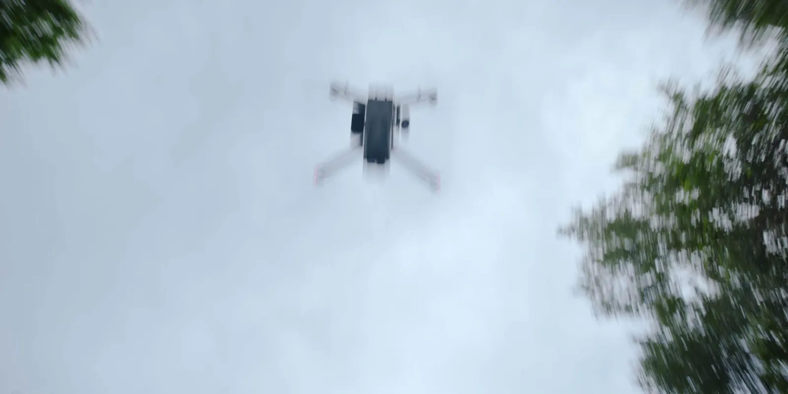
ปลอดภัยแม้เกิดเหตุไม่คาดคิด

ตั้งแต่การรับรู้และเตือนโดรนลำอื่นจนถึงการลงจอดฉุกเฉิน Matrice 5TD พร้อมรับมือเหตุไม่คาดคิด ร่มชูชีพช่วยชะลอการตกเพื่อปกป้องคนและทรัพย์สินบนพื้น ระบบเตือนอากาศยานใกล้เคียงช่วยให้น่านฟ้าปลอดภัย และ High-Wind Descent RTH พาโดรนกลับบ้านได้อย่างปลอดภัยเมื่ออากาศรุนแรง
ร่มชูชีพ

ร่มชูชีพ

ติดด้านบนของ Matrice 5TD มีแหล่งไฟแยกอิสระ ระบบสำรองทั้งเส้นทาง กางได้ทั้งอัตโนมัติและสั่งเอง พร้อม FTS ที่เป็นไปตามข้อกำหนด EU C5/C6 และ UK5/UK6 19
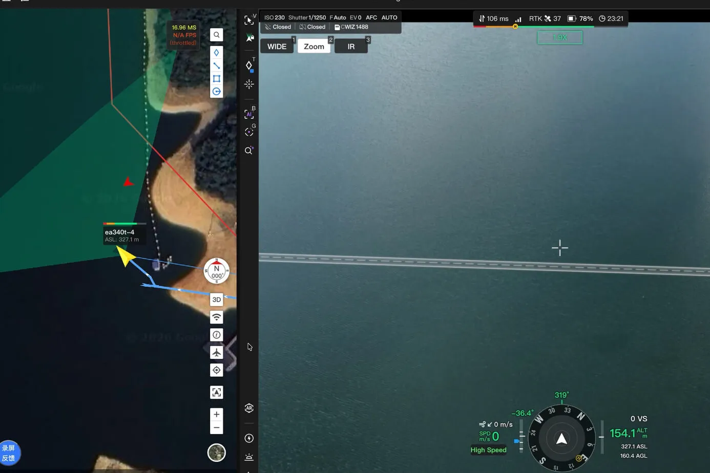
รับรู้และเตือนโดรนลำอื่น

รับรู้และเตือนโดรนลำอื่น

ตัวรับ ADS-B และ RID ในตัวของ Matrice 5TD ช่วยเตือนอากาศยานและโดรน DJI ที่เปิด RID อยู่ใกล้ ๆ 20 และแสดงเส้นทางบนแผนที่
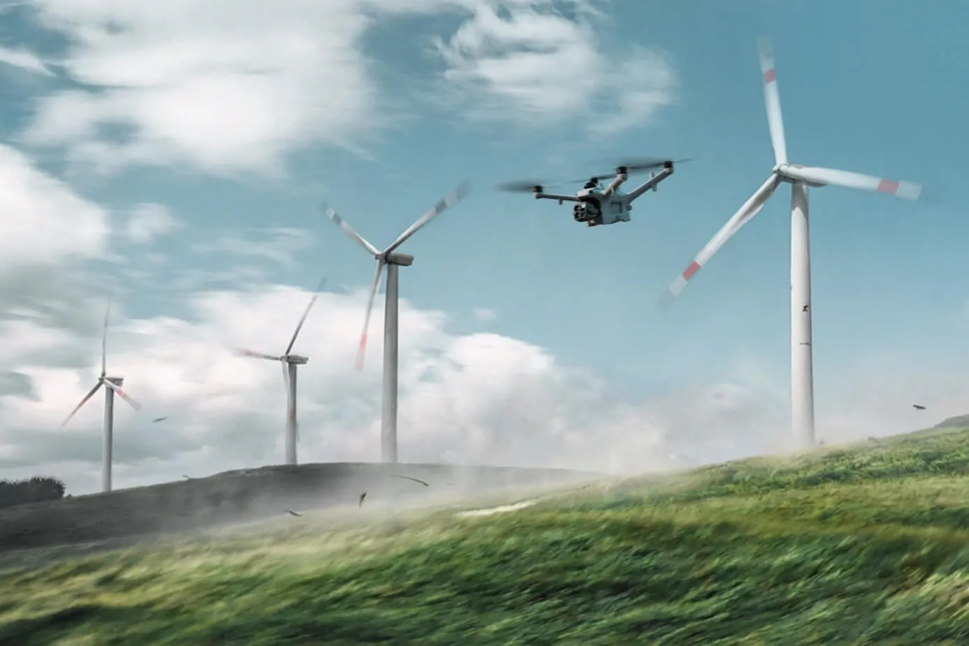
High-Wind Descent RTH

High-Wind Descent RTH

Matrice 5TD ขึ้น-ลงจอดและทำงานได้ในลมแรงถึง 12 ม./วิ หากลมแรงขึ้นระหว่างบินกลับ โดรนจะลดระดับแล้วบินกลับอย่างปลอดภัย แม้เหนือภูเขาและป่า

AI-Powered Workflow

เวิร์กโฟลว์อัจฉริยะด้วย AI 3

เวิร์กโฟลว์อัจฉริยะด้วย AI [3]

เห็นมากขึ้น เข้าใจมากขึ้น

AI บน Matrice 5TD ตรวจจับวัตถุได้ 17 ประเภทแบบเรียลไทม์ และ Virtual Cockpit ให้ค้นหาวัตถุแทบทุกชนิดได้ด้วยข้อความหรือรูปภาพ
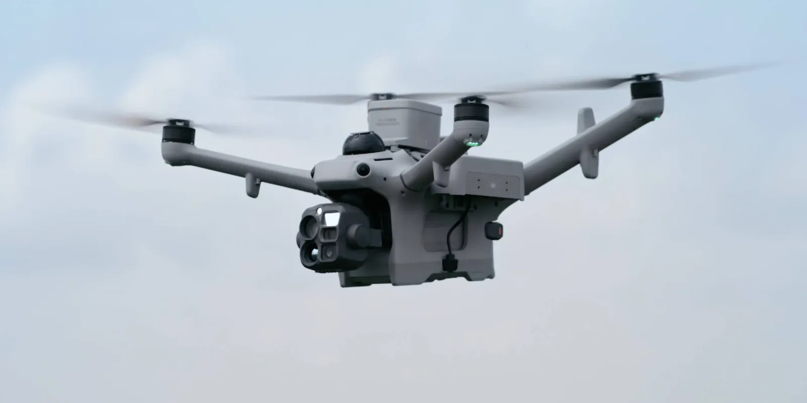
ตรวจจับบนโดรน

ตรวจจับบนโดรน

Matrice 5TD วิเคราะห์ภาพสดด้วย AI แบบเรียลไทม์ ครอบคลุม 17 ประเภทวัตถุ พร้อมตรวจจับจุดร้อนจากภาพอินฟราเรด และรองรับโมเดล AI ของผู้พัฒนาภายนอก
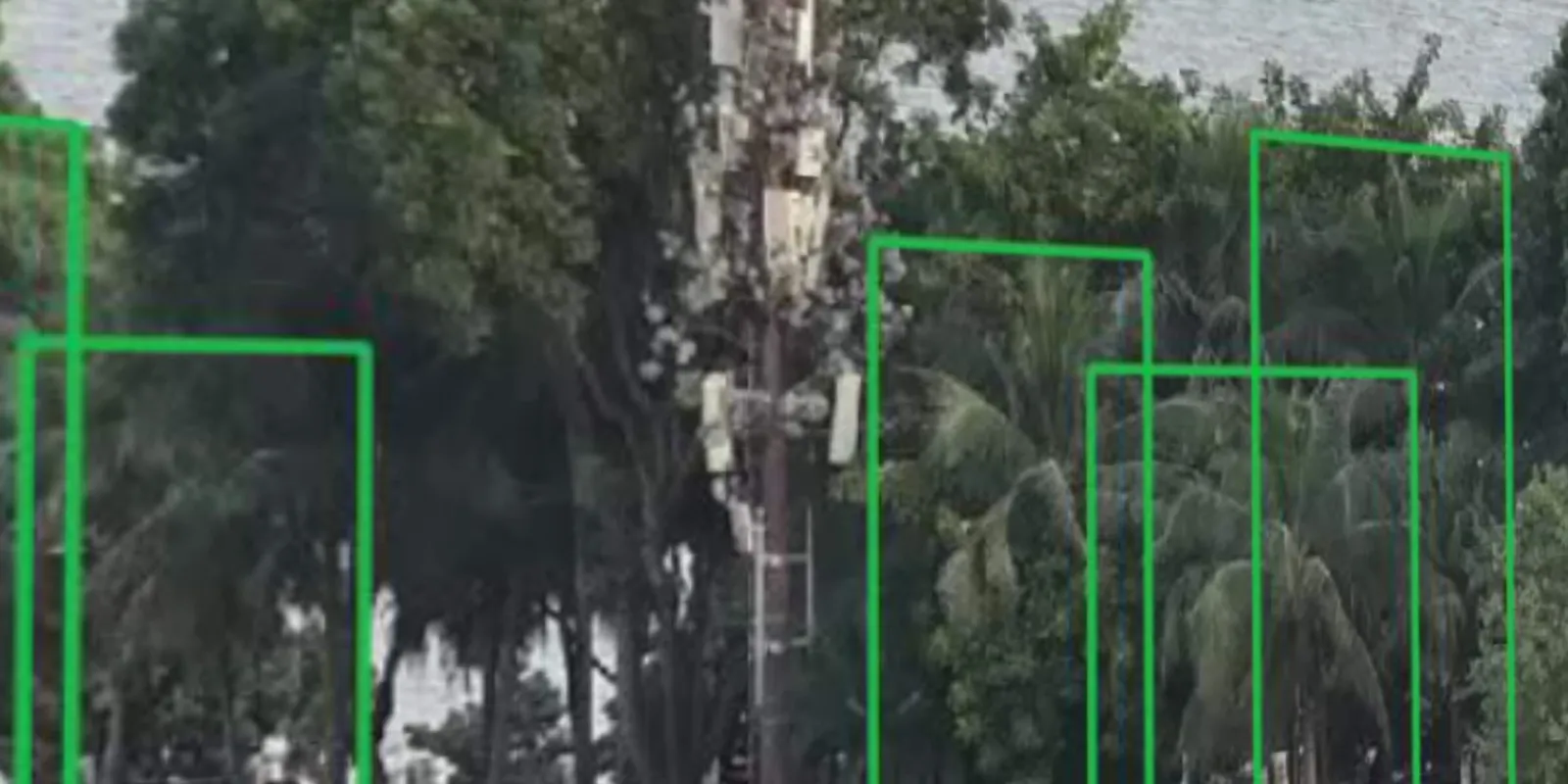
ค้นหาวัตถุด้วยข้อความหรือภาพ

ค้นหาวัตถุด้วยข้อความหรือภาพ

ใน Virtual Cockpit ค้นหาวัตถุได้ด้วยข้อความหรือรูปภาพ โมเดล AI แบบหลายรูปแบบ (Multimodal LLM) แปลความหมายคำสั่ง ตรวจจับวัตถุ และแจ้งเตือนเพื่อให้เห็นสถานการณ์

จากการแจ้งเตือนสู่การลงมือ โดยอัตโนมัติ

เมื่อพบความผิดปกติ ระบบส่ง SMS อีเมล หรือแจ้งเตือนบนแพลตฟอร์ม และสั่งการต่อได้ เช่น ถ่ายภาพ บันทึกวิดีโอ ติดตามเป้าหมาย หรือบินลอยตัว ครบวงจรตั้งแต่ตรวจพบจนถึงตอบสนอง

FlightHub 2 Copilot

FlightHub 2 Copilot

ตั้งแต่การควบคุมโดรน คำสั่งบิน เส้นทาง ไปจนถึงงานตามกำหนดเวลา แค่พิมพ์บอกเป็นภาษาธรรมดา FlightHub 2 Copilot แปลงเป็นคำสั่งให้โดรน
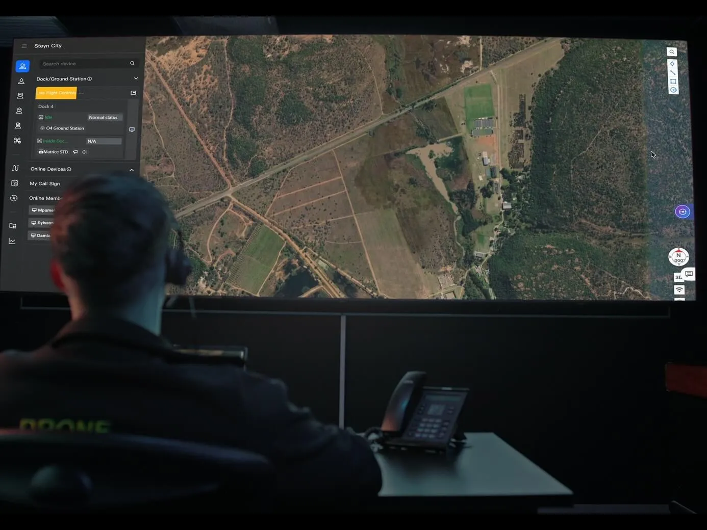
เวิร์กโฟลว์อัตโนมัติ

เวิร์กโฟลว์อัตโนมัติ

เวิร์กโฟลว์แบบทริกเกอร์ส่งโดรนออกเมื่อได้รับแจ้งเตือนจากระบบภายนอก เช่น เหตุแจ้ง DFR ส่วนเวิร์กโฟลว์ตามรอบเวลาเก็บข้อมูล สร้างโมเดล วิเคราะห์ และทำรายงานให้อัตโนมัติ

AI ประมวลผลหลังบิน ได้รายงานในไม่กี่นาที

หลังจบงานแต่ละครั้ง ระบบใช้ AI เทียบข้อมูลล่าสุดกับภาพถ่ายทางอากาศหรือโมเดล 3D ในอดีต ทำเครื่องหมายผลลัพธ์อัตโนมัติ และส่งออกเป็นรายงาน
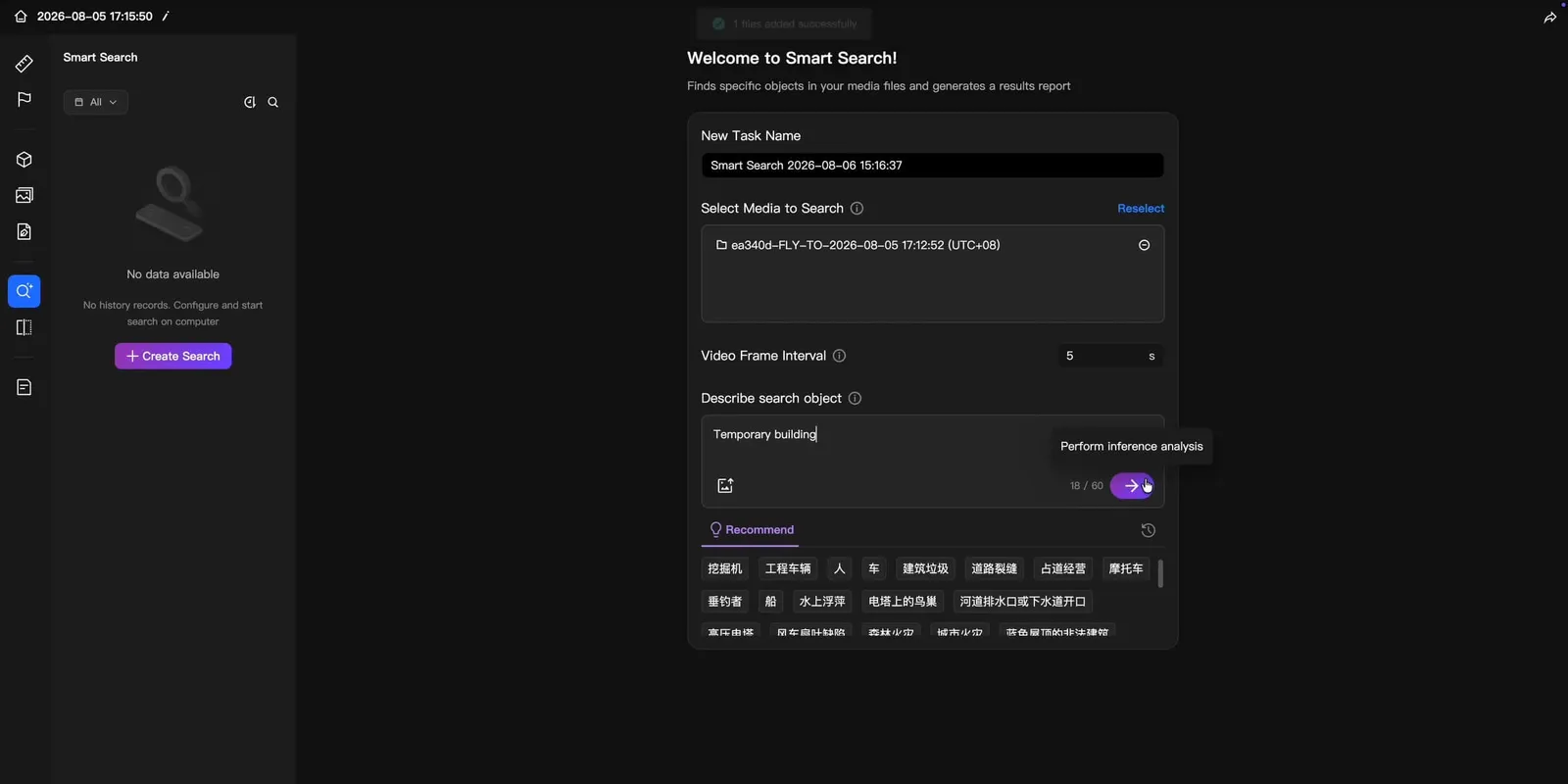
ตรวจจับอัจฉริยะหลังบิน

ตรวจจับอัจฉริยะหลังบิน

เทียบกับภาพถ่ายทางอากาศในอดีตเพื่อชี้ความเสียหายของสิ่งก่อสร้าง การเปลี่ยนแปลงของพื้นดิน และสิ่งปลูกสร้างใหม่ที่ไม่ได้รับอนุญาตโดยอัตโนมัติ
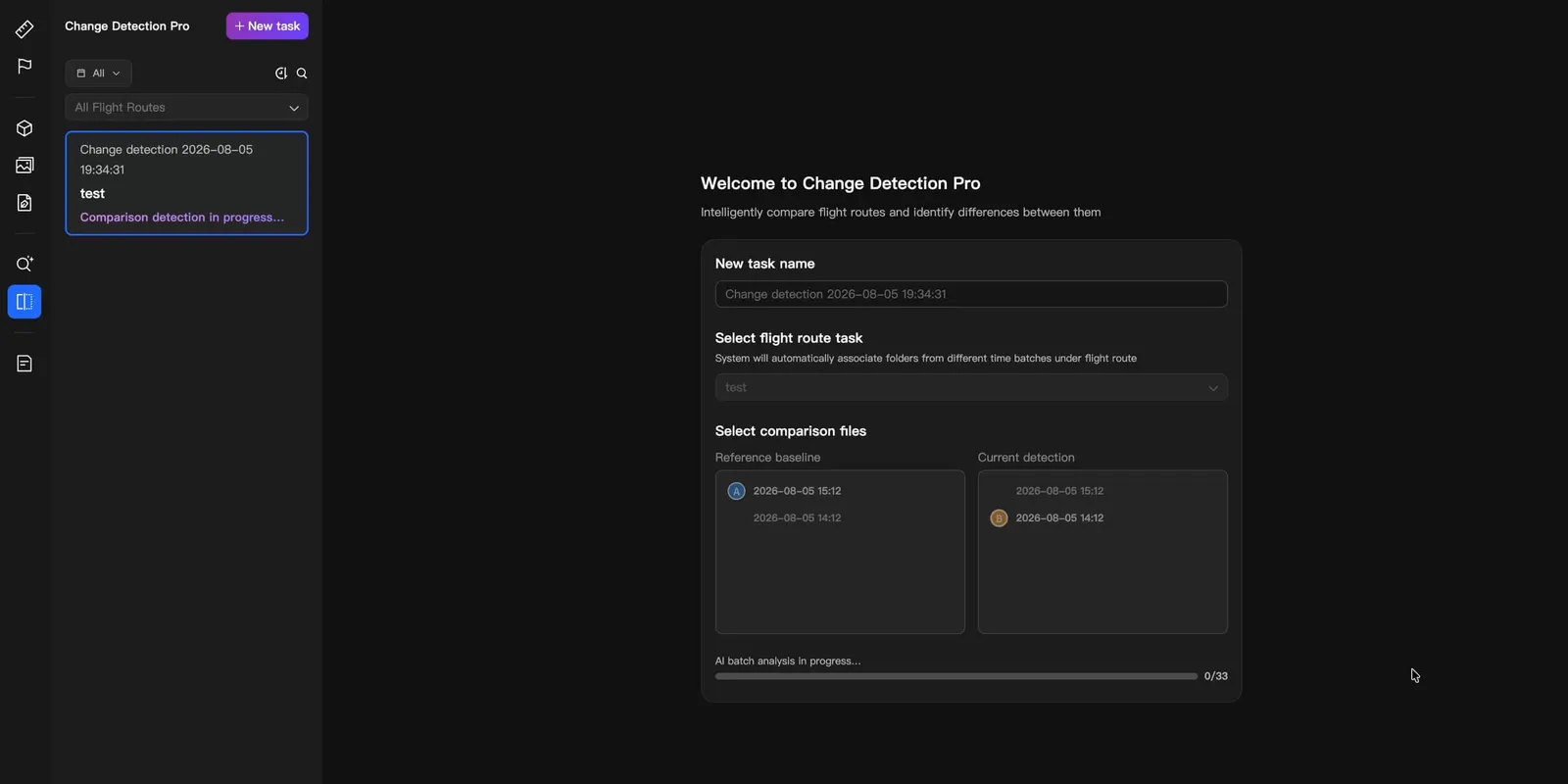
Change Detection Pro

Change Detection Pro

AI เทียบภาพถ่ายทางอากาศในอดีต ทำเครื่องหมายพื้นที่ที่เปลี่ยนไป และสร้างรายงาน ย่องานหลายชั่วโมงเหลือไม่กี่นาที ไม่ต้องไล่ดูทีละภาพ

Integrated Software
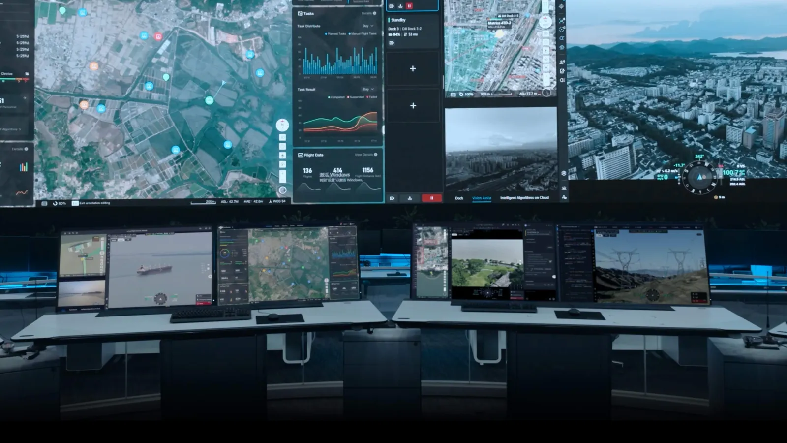
โซลูชันครบด้วยซอฟต์แวร์ที่เชื่อมกันทั้งระบบ

โซลูชันครบด้วยซอฟต์แวร์ที่เชื่อมกันทั้งระบบ

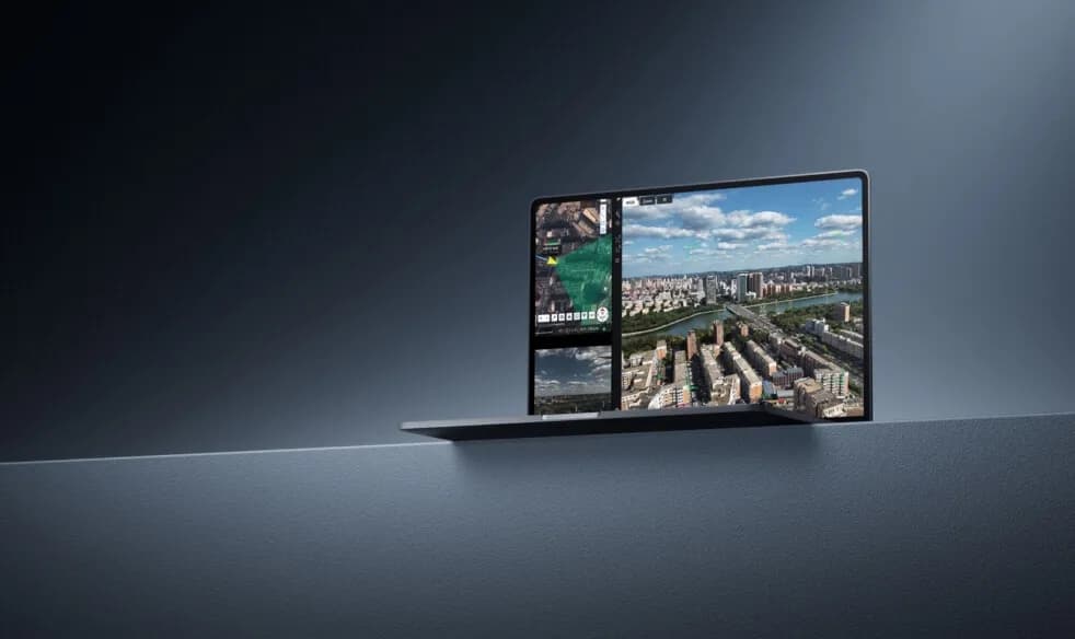
DJI FlightHub 2 แพลตฟอร์มคลาวด์ครบในที่เดียว

DJI FlightHub 2 รวมการติดตั้งใช้งานรวดเร็ว ควบคุมระยะไกลหน่วงต่ำ ภารกิจตามเส้นทางอัตโนมัติ ตรวจจับบนคลาวด์แบบเรียลไทม์ AI แบบหลายรูปแบบ การประมวลผลหลังบิน การแจ้งเตือนความผิดปกติ และอัปเดต OTA ไว้ในแพลตฟอร์มเดียว ครอบคลุมทุกขั้นตั้งแต่ติดตั้ง ปฏิบัติงาน ประสานงานอากาศ-ภาคพื้น จนถึงการดูแลระยะยาว
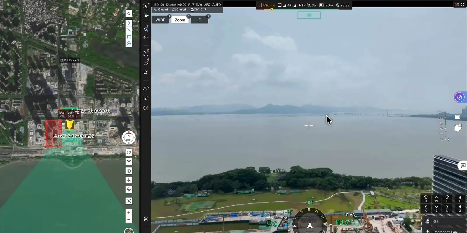
Cockpit เส้นทาง และแดชบอร์ด

Cockpit เส้นทาง และแดชบอร์ด

ควบคุมระยะไกลผ่าน Virtual Cockpit แก้ไขเส้นทาง จัดการงานตามไทม์ไลน์ ภาพสดหลายช่อง และแดชบอร์ดรวม ทำให้ศูนย์สั่งการเข้าใกล้หน้างานมากขึ้น
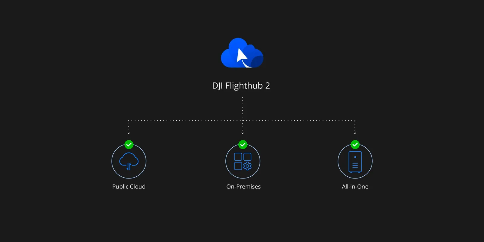
เลือกรูปแบบการติดตั้งได้

เลือกรูปแบบการติดตั้งได้

DJI FlightHub 2 มีทั้งแบบคลาวด์สาธารณะ (SaaS) เครื่อง All-in-One และแบบติดตั้งในองค์กร (On-Premises) รองรับความต้องการด้านการติดตั้งและความปลอดภัยของข้อมูลที่ต่างกัน
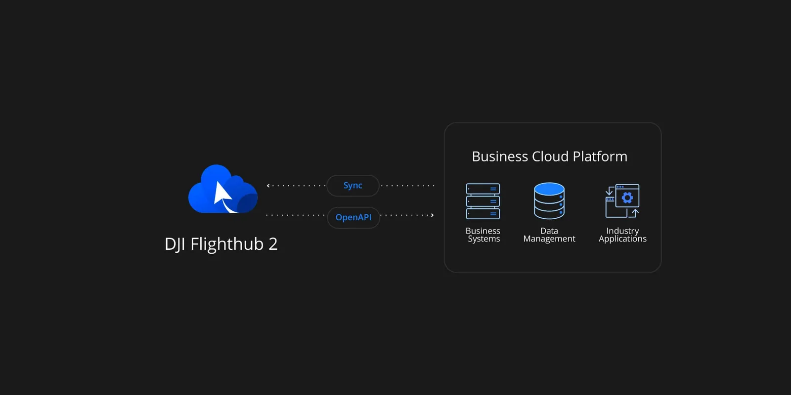
OpenAPI และ FlightHub Sync

OpenAPI และ FlightHub Sync

FlightHub 2 เชื่อมกับแพลตฟอร์มคลาวด์อื่นผ่าน FlightHub Sync โดยไม่ต้องเขียนโค้ด นักพัฒนาใช้ OpenAPI 21 เชื่อมฟังก์ชันและงาน 2D/3D ได้ ลดต้นทุน (ขอบเขต OpenAPI ของคลาวด์สาธารณะและ On-Premises ต่างกัน)

DJI Enterprise App ควบคุมได้จากกระเป๋า

แอป DJI Enterprise ใช้ตั้งค่าหน้างานและเป็นทางเข้าสู่การปฏิบัติงานระยะไกล นอกจากตั้งค่าและทดสอบ Dock แล้ว ยังสั่งงานและดูภาพระยะไกลได้
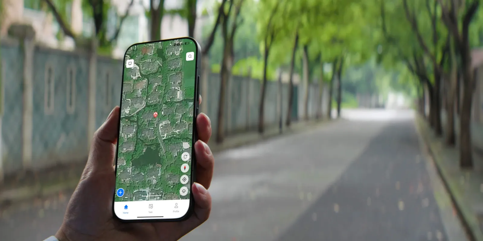
ส่งโดรนออกด้วยปุ่มเดียว

ส่งโดรนออกด้วยปุ่มเดียว

สั่งงานจากแอปเพื่อปลุกโดรนและส่งไปยังจุดหมายในไม่กี่วินาที สำหรับการตอบสนองเหตุฉุกเฉินอย่างรวดเร็ว
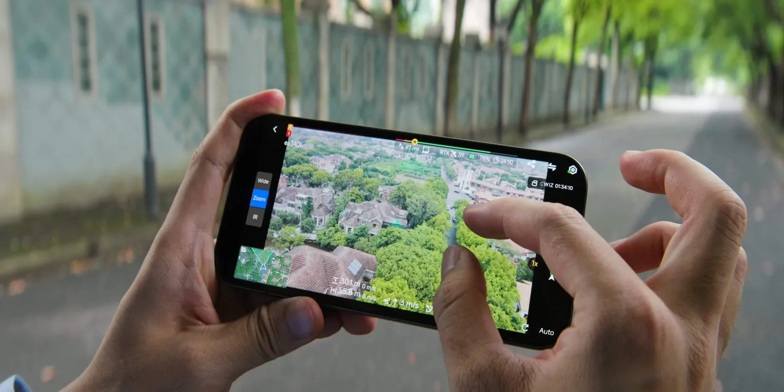
ควบคุมระยะไกล

ควบคุมระยะไกล

ภาพสดหน่วงต่ำ 6 ให้ทีมที่อยู่ไกลเห็นหน้างานแบบเรียลไทม์ ตัดสินใจได้จากนอกพื้นที่

Secure & Compliant
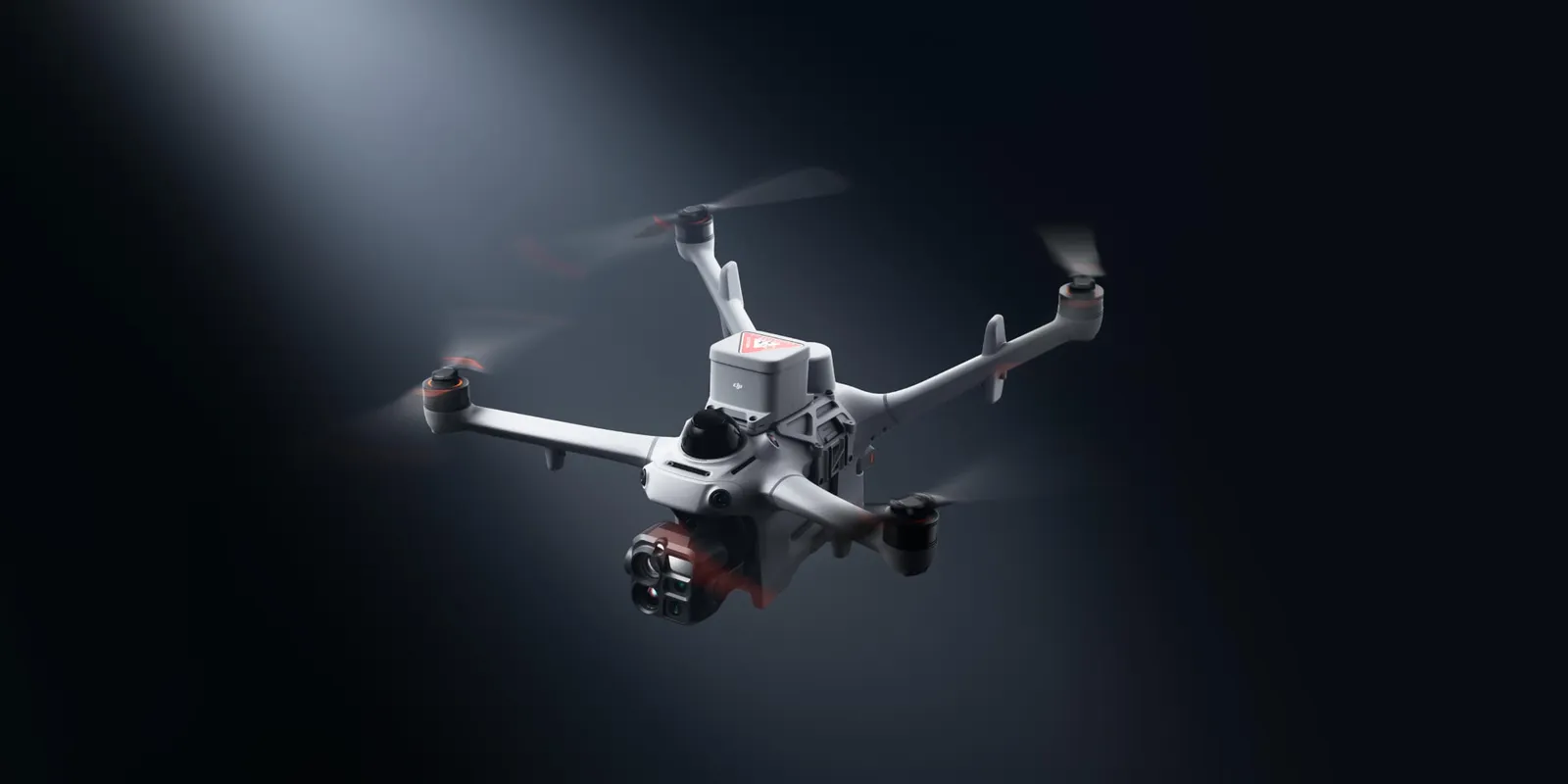
ปลอดภัยและเป็นไปตามข้อกำหนด

ปลอดภัยและเป็นไปตามข้อกำหนด

ลดความเสี่ยงภาคพื้นดิน

ด้วยร่มชูชีพที่ DJI ออกแบบ เขตการบินที่กำหนดเอง และระบบควบคุมการบินที่ออกแบบให้เป็นไปตามข้อกำหนดตั้งแต่ต้น DJI Dock 4 ช่วยลดความเสี่ยงและรองรับการบินที่ถูกต้องตามกฎในเมืองและพื้นที่ซับซ้อน

ระบบร่มชูชีพ DJI

ระบบร่มชูชีพ DJI

ร่มชูชีพจาก DJI ช่วยลดแรงกระแทกหากระบบขัดข้องกะทันหัน
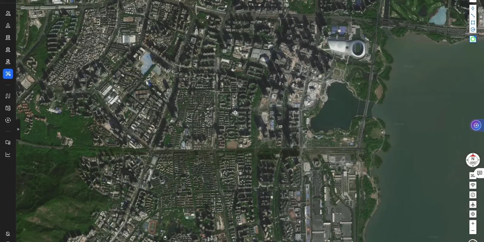
เขตการบินที่กำหนดเอง

เขตการบินที่กำหนดเอง

บังคับใช้โดยระบบควบคุมการบินโดยตรง เขตการบินที่กำหนดไว้ทำให้โดรนอยู่ในพื้นที่ที่ตั้งไว้ ลดความเสี่ยงบินออกนอกเขตที่ได้รับอนุญาต

ลดความเสี่ยงในน่านฟ้า

การรับรู้ Remote ID, AirSense และข้อมูลน่านฟ้าจากภายนอก ช่วยให้ผู้ปฏิบัติงานเห็นสถานการณ์แบบเรียลไทม์ ประเมินความเสี่ยงก่อนทุกภารกิจ และตัดสินใจได้ถูกต้องระหว่างบิน
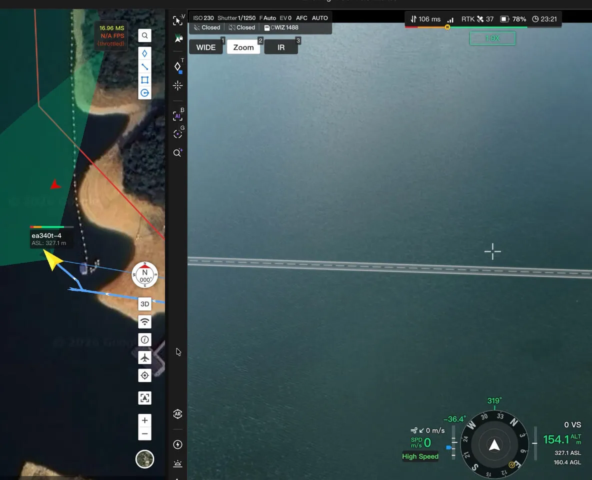
O4 Ground Station รับรู้น่านฟ้า

O4 Ground Station รับรู้น่านฟ้า

DJI O4 Ground Station เชื่อมตัวรับ Remote ID ภายนอกผ่าน MQTT เพื่อรับรู้โดรนหรืออากาศยานที่มีคนขับใกล้เคียงแบบเรียลไทม์
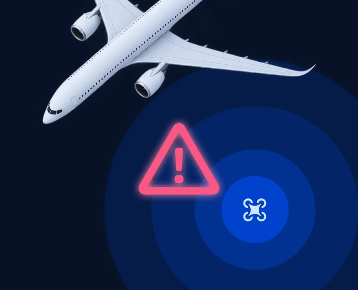
โดรนรับรู้น่านฟ้าเอง

โดรนรับรู้น่านฟ้าเอง

Matrice 5TD รับสัญญาณ ADS-B จากอากาศยานใกล้เคียงและรับรู้โดรนลำอื่น 20 แสดงสถานะบน FlightHub 2 ช่วยให้เห็นความเสี่ยง
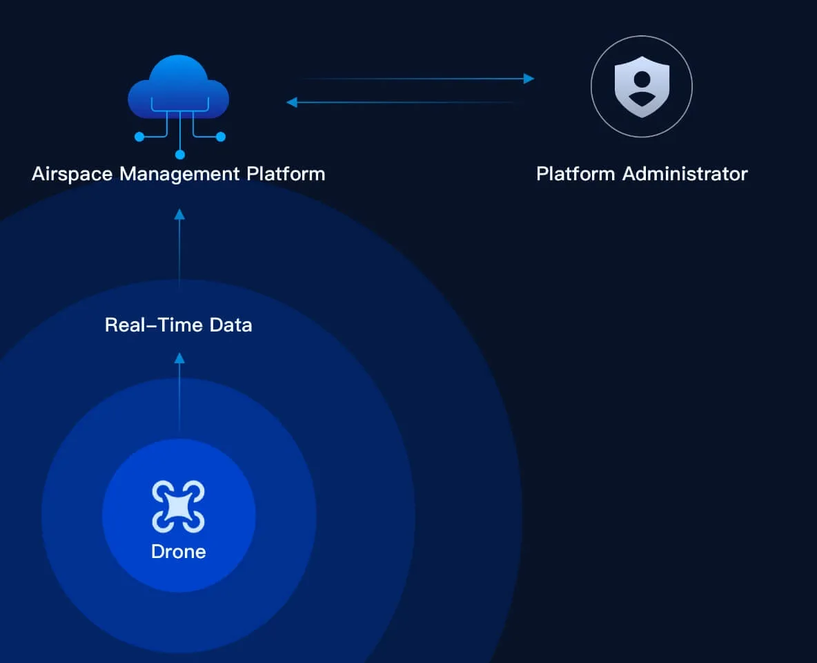
ข้อมูลน่านฟ้าจากภายนอก

ข้อมูลน่านฟ้าจากภายนอก

เชื่อมบริการข้อมูลน่านฟ้าภายนอก แสดงสภาพ ข้อจำกัด และคำเตือนความเสี่ยงใกล้พื้นที่ภารกิจ ช่วยตัดสินใจทั้งก่อนและระหว่างภารกิจ

การปกป้องข้อมูล

ข้อมูลได้รับการเข้ารหัสและควบคุมการเข้าถึงทุกขั้น ตั้งแต่เกิดข้อมูล ส่งต่อ จัดเก็บ จนถึงการลบ
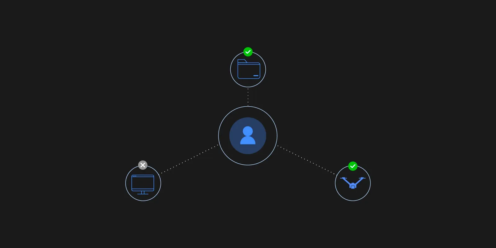
ขั้นเก็บข้อมูล

ขั้นเก็บข้อมูล

ข้อมูลธุรกิจ การบิน และอุปกรณ์ที่เกิดขึ้น เข้าช่องทางเข้ารหัสทันที ป้องกันการดักฟัง การแย่งชิง และการโจมตีแบบคนกลาง
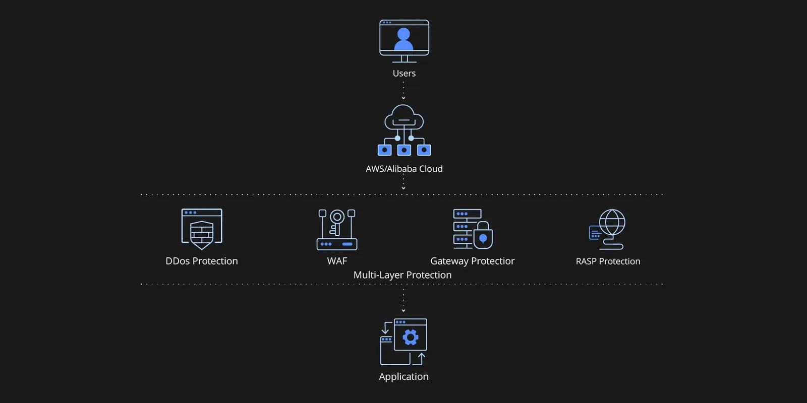
ขั้นส่งข้อมูล

ขั้นส่งข้อมูล

เข้ารหัสทุกจุดส่งข้อมูล โดรนถึง Dock ใช้ TLS 1.2+ และ AES-256 ส่วน Dock ถึงคลาวด์ใช้ HTTPS, WSS และ TLS ป้องกันข้อมูลถูกดักหรือแก้ไขระหว่างทาง
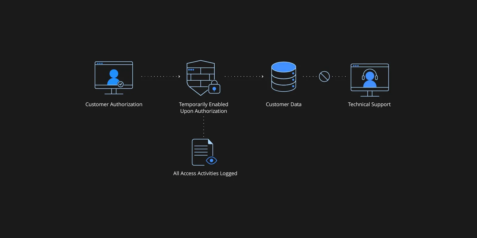
ขั้นจัดเก็บ

ขั้นจัดเก็บ

เข้ารหัส AES-256-CBC สำหรับข้อมูลสำคัญอย่างอีเมล เบอร์โทร และตำแหน่ง ควบคุมสิทธิ์เข้าถึงอย่างเข้มงวด และบันทึกการเข้าถึงทุกครั้งเพื่อตรวจสอบย้อนหลัง
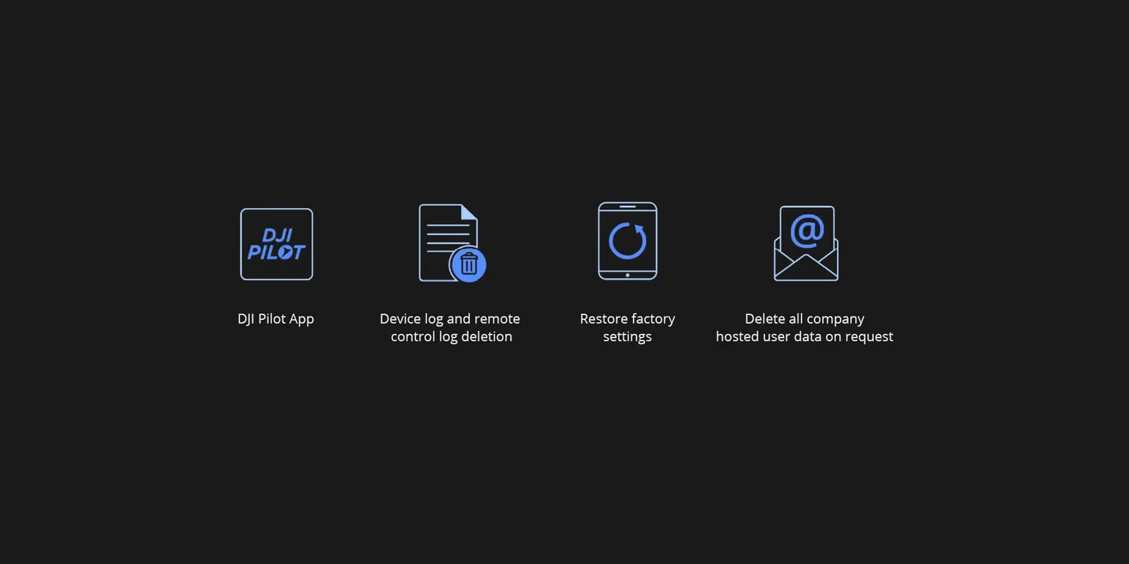
ขั้นลบข้อมูล

ขั้นลบข้อมูล

ลบได้ 3 ระดับ: บัญชี องค์กร และอุปกรณ์ ลบบัญชีจะลบเฉพาะข้อมูลผู้ใช้นั้น ลบองค์กรจะลบข้อมูลทั้งหมดขององค์กร และที่ระดับอุปกรณ์ล้างบันทึกในเครื่องผ่านแอป DJI Pilot หรือรีเซ็ตเป็นค่าโรงงานได้

Open Ecosystem

ระบบเปิด ต่อยอดได้ไม่จำกัด

แพลตฟอร์มประมวลผลอัจฉริยะแบบเปิด

การอัปเกรด AI Inside ใช้สถาปัตยกรรมโมเดลใหม่ที่รองรับการเข้ารหัสภาพสองสตรีม พร้อมเครื่องมือ Quantize โมเดลและช่องทางติดตั้งอัลกอริทึมบนโดรน เปิดทางสู่แอปพลิเคชันโดรนอัจฉริยะใหม่ ๆ

อุปกรณ์เสริมจากผู้ผลิตอื่น

โดรนมีพอร์ต E-Port 3 ช่อง รับน้ำหนักได้ถึง 450 ก. ติดเครื่องตรวจก๊าซ เครื่องวัดการไหล และอุปกรณ์อื่นได้ ขยายการใช้งานได้หลากหลายขึ้น

ปลั๊กอินเว็บ TerraGS-CesiumJS

สร้างบน CesiumJS ให้ซอฟต์แวร์ภายนอกโหลด แสดงผล และโต้ตอบกับข้อมูล 3DGS ขนาดใหญ่ความแม่นยำสูงแบบเรียลไทม์ ใช้กับงานโมเดล 3D ระดับเมือง Mixed Reality และ Digital Twin

เชื่อมคลาวด์ถึงคลาวด์

ใช้ Open API ของ DJI FlightHub 2 เชื่อมกับแพลตฟอร์มคลาวด์ภายนอกได้รวดเร็ว จัดการข้อมูลการปฏิบัติงานได้ง่าย

Service & Support

บริการและการดูแล

DJI ประกาศสิทธิ์ความคุ้มครองปีแรกสำหรับ Dock 4 และ Matrice 5TD แต่เงื่อนไขแตกต่างกันในแต่ละประเทศ 23 กรุณาสอบถามสิทธิ์ที่ใช้ได้ในประเทศไทยกับทีมงานก่อนสั่งซื้อ

DJI Care Enterprise Plus สำหรับ DJI Dock 4

  • ซ่อมฟรีไม่จำกัดครั้งภายในวงเงินความคุ้มครอง (ค่าอะไหล่) 22
  • ใช้วงเงินร่วมกันทั้งฝูงโดรน
  • ทีมผู้เชี่ยวชาญ DJI ตอบสนองรวดเร็ว

DJI Care Enterprise Plus สำหรับ DJI Matrice 5TD

  • ซ่อมฟรีไม่จำกัดครั้งภายในวงเงินความคุ้มครอง
  • เปลี่ยนแบตเตอรี่ฟรีปีละ 1 ครั้ง
  • คุ้มครองกรณีโดรนสูญหายระหว่างบินปีละ 1 ครั้ง
  • ส่งซ่อมฟรีทั้งไป-กลับในพื้นที่ที่ให้บริการ

Official Extended Warranty สำหรับ DJI Matrice 5TD

  • ดูแลโดยทีมวิศวกรมืออาชีพ
  • อะไหล่แท้ รับประกันคุณภาพการซ่อม
  • ขยายประกันเพิ่ม 1 ปี ครอบคลุมตัวโดรน กล้องกิมบอล และ O4 Ground Station 26

Specifications

สเปก DJI Dock 4 และ Matrice 5TD

ข้อมูลจาก DJI (ภาษาอังกฤษตามต้นฉบับ) · 212 รายการ

Dock — ทั่วไป
Product Name
DJI Dock 4
Total Weight
66 kg (without batteries in the battery compartment, aircraft not included)The actual product weight may vary due to differences in batch materials and external factors.
Dimensions
Dock Cover Opened: 1750×640×550 mm (L×W×H) Dock Cover Closed: 639×640×836 mm (L×W×H)All data includes the wind speed gauge height (145 mm) and mounting base brackets (69 mm).
Input Voltage
100-240 V (AC), 50/60 Hz
Input Power
Max 2000 W
Operating Temperature
-40° to 50° C (-40° to 122° F)
Ingress Protection Rating
IP56
Max Operating Altitude
5000 m
Number of Drones Accommodated
1
Max Allowable Landing Wind Speed
12 m/s
RTK Base Station
Supported via DJI O4 Ground Station
Receiving Frequency of RTK Base Station Satellite
Supported via DJI O4 Ground Station
Dock — การชาร์จและสลับแบตเตอรี่
Charging Method
Battery Swapping + Wireless Charging
Battery Swap Time
< 25 sTime elapsed from when the Dock Cover is fully closed to the completion of the battery swap. Measured in a controlled test environment and is for reference only.
Operational Turnaround Time
< 45 sTime elapsed from when the aircraft lands from the previous flight to when it completes the battery swap and takes off again. Measured in a controlled test environment and is for reference only.
Max Number of Batteries Stored Across All Battery Compartments
3The dock has four battery compartments, each designed to hold one battery. To ensure proper operation of the battery-swapping mechanism, no more than three of the four compartments may contain a battery at any given time.
Max Number of Parallel Charging Channels
2
Output Voltage
Per-channel output voltage: 15-25.8 V DC
Charging Time
Per-battery charging time: 27 minutesTime required to charge the battery in the battery compartment from 15% to 95% level in a 25° C (77° F) environment.
Dock — การส่งภาพ
Operating Frequency
High-speed Wi-Fi connection: 2.4000-2.4835 GHz: 5.7250-5.8500 GHz: DJI O4 Enterprise Enhanced Video Transmission System: Supported via DJI O4 Ground StationThe supported operating frequency bands and their corresponding availability vary by country/region. For details, please refer to local laws and regulations.
Antenna
High-speed Wi-Fi connection: Single antenna DJI O4 Enterprise Enhanced Video Transmission System: Integrated into the O4 Ground Station
Dock — ระบบปรับอากาศ
Air Conditioning Type
Compressor-based air conditioning
Operating Voltage
48 V DC
Dock — แบตเตอรี่สำรอง
Backup Power Supply Method
Backup power is supplied by the aircraft battery housed in the dock battery compartment.
Battery Capacity
12138 mAh
Output Voltage
21.42 V
Battery Type
LiNiMnCoO2
Battery Life
Operating time per battery: approx. 4.5 hours Supports sequential power supply across three batteriesMeasured in a 25° C (77° F) environment with the backup battery discharged from 90% to 10%. After a power outage, the dock does not support functions like aircraft charging, air conditioning operation, and wind speed gauge heating. Please restore power promptly.
Dock — การเชื่อมต่อเครือข่าย
Ethernet Access
Supported (requires connection to DJI O4 Ground Station)
4G Access
Requires use with DJI Cellular Dongle 2 (installed on DJI O4 Ground Station).
Dock — เซนเซอร์
Wind Speed Sensor
Supported
Rainfall Sensor
Supported
Ambient Temperature Sensor
Supported
In-Cabin Temperature Sensor
Supported
In-Cabin Humidity Sensor
Supported
Dock — กล้องวงจรปิด (ภายนอก)
Resolution
1920×1080
Field of View (FOV)
151°
Auxiliary Light
Auxiliary White Light
Dock — กล้องวงจรปิด (ภายใน)
Resolution
1920×1080
FOV
151°
Auxiliary Light
Auxiliary White Light
Dock — ป้องกันฟ้าผ่า
AC Power Port
20 kA (rated value), meets EN 61643-11 Type 2 and IEC 61643-1 Class Ⅱ protection level requirements
Ethernet Port
10 kA (Itotal), meets EN/IEC 61643-21 Category C protection level requirements
Dock — ซอฟต์แวร์ที่รองรับ
Applications
DJI Enterprise App (for on-site setup, testing, remote operations, live viewing, and one-tap drone dispatch)
Cloud Platform
FlightHub 2 FlightHub 2 On-Premises Version FlightHub 2 FlightHub Sync DJI Cloud API
O4 Ground Station — ทั่วไป
Dimensions
170×170×352 mm
Weight
2.68 kg
Operating Temperature
Direct connection to DJI Dock power supply: -40° to 55° C (-40° to 131° F)The 55° C (131° F) upper limit accounts for solar radiation. At -40° C (-40° F), the device requires a windless environment; auto-restart after shutdown is not supported in windy conditions. After storage or operation in extreme temperatures, allow the internal backup battery to return to between 0° and 45° C (32° and 113° F) before charging.
PoE Auto Wake-Up
When connected to the DJI Dock 4 PoE port, the device automatically wakes up when plugged in or when power is restored.
Cold-Weather Heating Startup
Supported
Ingress Protection Rating
IP67Please follow the requirements stated in the IP67 protection rating instructions. Measured in a controlled environment. The IP rating is not permanently effective and may decrease due to product wear and tear.When the O4 Ground Station is installed close to the dock, use the Ethernet cable included in the package. When it is installed farther away, use the included waterproof Ethernet port connector. The cable must be Cat 6 or above outdoor-rated, waterproof twisted-pair cable with an outer diameter of 5.5 to 6.5 mm. Install the corrugated tubing and corrugated tubing plug, crimp the RJ45 connector, and tighten the connector nut.Ensure all rubber port covers and the DJI Cellular Dongle 2 heat sink are properly installed. Unused WAN/LAN port screws must be fully tightened.
O4 Ground Station — ตัวรับ GNSS
GNSS Frequency
GPS: L1C/A, L2C, L5 BDS: B1I, B2I, B3I, B1C, B2a, B2b GALILEO: E1, E5a, E5b, E6 GLONASS: L1, L2 QZSS: L1C/A, L2C, L5 L-Band
System Accuracy
Horizontal: 1.0 cm (RMS) + 1 ppm Vertical: 3.0 cm (RMS) + 1 ppmRTK calibration is required. Measurement accuracy depends on various factors. This value is obtained under normal conditions with an unobstructed view, good satellite distribution, low ionospheric activity, and no electromagnetic interference or multipath effects.
O4 Ground Station — การส่งภาพ
Video Transmission
DJI O4 Enterprise Enhanced Video Transmission System
Operating Frequency and Transmitter Power (EIRP)
902 MHz to 928 MHz: 2.400 GHz to 2.4835 GHz: 5.150 GHz to 5.250 GHz: 5.170 GHz to 5.250 GHz: 5.725 GHz to 5.850 GHz: < 33 dBm (IC), < 14 dBm (CE), < 30 dBm (SRRC)Operating frequency allowed varies among countries and regions. Refer to local laws and regulations for more information.
Antenna
OcuSync 4 Pro external directional antenna × 4 OcuSync 4 Pro internal directional antenna × 8 2.4G/5.2G/5.8G: 2T4R sub2G: 2T2R 4G Antenna × 2Operating frequency allowed varies among countries and regions. Refer to local laws and regulations for more information.
Network Access
Ethernet Access: Adaptive Ethernet port; Gigabit network is recommended, with both uplink and downlink bandwidth > 20 Mbps, preferably > 40 Mbps (when no other peripherals are connected), and network latency ≤ 100 ms for a better user experience* 4G Access: Requires the DJI Cellular Dongle 2*** If these requirements are not met, the device may go offline or experience video stuttering.** Sold separately. This service is not available in some countries and regions. Please consult your local dealer for details.
O4 Ground Station — ไฟฟ้า
Power Interface
Ethernet Port (PoE) WAN: PoE-in LAN: PoE-in
Ethernet Cable Requirements
Cat 6 or above outdoor-rated, waterproof twisted-pair cable; max length 80 m; outer diameter 5.5 to 6.5 mmTo reduce the risk of waterproofing failure and other reliability issues, use the Ethernet cable included with the DJI Dock for cable runs of less than 5 m from the Dock.
Power Consumption*
With DJI Dock 4: Max Power Consumption (Including Heating): 65 W Typical Power Consumption (Without Heating): 17.1 W Low-Power Mode: 7 W*** Measured in a controlled test environment and should be used for reference only. Actual power draw may be higher when accounting for losses in the power supply.** Low-power mode is not recommended for use at temperatures of -40° to -20° C (-40° to -4° F).
Backup Battery
Li-ion Capacity: 3250 mAh Energy: 23.4 Wh
Backup Battery Operating Time (at room temperature)
Battery preservation mode is enabled by default when powered via PoE. In the event of a sudden power loss, estimated runtime is 45 minutes.Battery preservation mode: when powered via PoE, the system keeps battery voltage between 7.0 V and 7.4 V. If the battery voltage at insertion exceeds 7.5 V, the system will discharge it to the safe threshold before entering preservation mode; the battery will not charge to full capacity.Battery discharge performance may decrease in low temperatures, reducing actual operating time.
Backup Battery Charging
Supports 9V or 12V PD charging. DJI 65W Portable Charger is recommended before deployment. When fully charged, estimated runtime is approx. 2 hours. Charge time (65W PD): approx. 2.5 hoursCharging with a 5V charger is only supported when the device is powered off.Charging is only supported when the battery cell temperature is between 0° and 55° C (32° and 131° F).
Ethernet Port Surge Protection
WAN/LAN Ports: Ethernet interface supports up to 10 kA (total discharge current) surge protection, meeting EN/IEC 61643-21 Category C.Surge protection capability depends on the capacity and reliability of grounding. To minimize the risk of surges, please make sure that grounding is done properly during installation.
O4 Ground Station — ซอฟต์แวร์ที่รองรับ
Supported Software
DJI Enterprise App (for on-site setup, testing, remote operations, live viewing, and one-tap drone dispatch)
Cloud Platform
FlightHub 2 FlightHub 2 On-Premises Version FlightHub 2 FlightHub Sync Third-party cloud platform developed based on DJI Cloud API
External Device Support
Supports cameras using ONVIF and GB/T 28181 protocols Supports up to 4 simultaneous 1080p H.264 video streamsThe camera and the WAN port of the DJI O4 Ground Station must be connected to the same upstream switch. For details, see the DJI O4 Ground Station - IP Camera Configuration Guide.
Open Ecosystem
ESDK 2.0
โดรน Matrice 5TD — ทั่วไป
Product Name
DJI Matrice 5TD
Weight
2600 gThis value includes the weight of the battery, propellers, and a microSD card, but does not include third-party payloads. The actual weight may vary due to differences in batch materials and external factors.
Max Takeoff Weight
3050 g
Dimensions
393×477×230 mm (L×W×H, without propellers)
Wheelbase
Diagonal Wheelbase: 549 mm
Max Ascent Speed
6 m/s
Max Descent Speed
6 m/s
Max Horizontal Speed (at sea level, no wind)
21 m/sCurrently, only FlyTo Tasks (Fly to a Target Point) support flight speeds of up to 21 m/s. In other modes, the maximum flight speed is 15 m/s.
Max Wind Speed Resistance
12 m/s
Max Takeoff Altitude
6500 mAircraft without payload.
Max Takeoff Altitude at Full Load
4500 m
Max Flight Time
59 minutesMeasured under the following conditions: in a windless laboratory environment at 20 meters above sea level, with the aircraft flying forward without payload at a constant speed of 15 m/s from 100% battery level until 0%. Results may vary depending on the environment, actual use, and firmware version.
Max Hovering Time
55 minutesMeasured with the aircraft hovering in a windless environment at 20 meters above sea level and from 100% battery level until 0%. Results may vary depending on the environment, actual use, and firmware version.
Max Operating Radius
10 kmMeasured in an environment of approximately 25° C (77° F) with a safe battery level of 15%, windless environment, round-trip flight speed of approximately 15 m/s, and hovering operation without payload of 25 minutes. Results may vary depending on the environment, actual use, and firmware version.
Max Flight Distance
53 kmMeasured with the aircraft flying at a constant speed of 15 m/s in a windless environment at 20 meters above sea level and from 100% battery level until 0%. Results may vary depending on the environment, actual use, and firmware version.
Max Pitch Angle
25°Currently supported in Normal Mode only.
Max Angular Velocity
75°/sCurrently supported in Normal Mode only.
Global Navigation Satellite System
GPS + Galileo + BeiDou + QZSS + GLONASS
Hovering Accuracy Range (windless or breezy)
Vertical: ±0.1 m (with vision positioning) ±0.04 m (with RTK positioning) Horizontal: ±0.3 m (with vision positioning) ±0.02 m (with RTK positioning)
Operating Temperature
-40° to 50° C (-40° to 122° F)
Ingress Protection Rating
IP55
Motor Model
3409.6
Propeller Model
1564F foldable low-noise anti-ice propellers
RTK Module
Integrated on the aircraft
Beacon
Integrated on the aircraft
Warning Light
A customizable multicolor warning light, integrated into the bottom of the aircraft
Accessory Mounting Points
Two on the sides and one on the topRequires the Matrice 5TD Accessory Mount.
โดรน — ระบบตรวจจับสิ่งกีดขวาง
Sensing Type
Omnidirectional binocular color vision system; horizontal rotating LiDAR; downward 3D infrared ranging sensor; and forward, upward, and downward mmWave radars
Forward
Measurement Range: 0.5 m to 25 m Detection Range: 0.5 m to 200 m Effective Sensing Speed: Flight Speed ≤ 15 m/s FOV: Horizontal 95°, Vertical 90°
Backward
Measurement Range: 0.5 m to 25 m Effective Sensing Speed: Flight Speed ≤ 15 m/s FOV: Horizontal 95°, Vertical 90°
Lateral
Measurement Range: 0.5 m to 25 m Effective Sensing Speed: Flight Speed ≤ 15 m/s FOV: Horizontal 90°, Vertical 90°
Upward
Measurement Range: 0.5 m to 20 m Effective Sensing Speed: Flight Speed ≤ 10 m/s FOV: Front and Back 95°, Left and Right 90°
Downward
Measurement Range: 0.5 m to 20 m Effective Sensing Speed: Flight Speed ≤ 8 m/s FOV: Front and Back 90°, Left and Right 95°
Operating Environment
Forward, Backward, Left, Right, and Upward: Surfaces with discernible patterns and adequate lighting (lux > 0.1) Downward: Diffuse reflective surface with discernible patterns, diffuse reflectivity > 20% (e.g. walls, trees, people), and adequate lighting (lux > 0.1)
Rotating LiDAR
Standard Measurement Range: 110 m @ 100,000 lux with 10% reflectivity target Measurement Range for Power Line: 32 m @ 30° @ 35,000 lux for 21.6 mm steel-core aluminum stranded wire with a relative body tilt angle of 30° to the left and right 19 m @ 30° @ 35,000 lux for 11 mm black rubber cable (with surface soiling) with a relative body tilt angle of 30° to the left and right Field of View (FOV): 360° (horizontal), 59° (vertical) Point-Frequency: 250,000-460,000 points/second Laser Wavelength: 940 nm Safety Classification: Class 1 (IEC 60825-1:2014)
Downward 3D Infrared Sensor
Measurement Range: 0.3-8 m (reflectivity > 10%) FOV: Front and Rear 60°, Left and Right 60°
Millimeter-Wave Radar
FOV: Vertical 90°, Horizontal 90° Front Millimeter-Wave Radar: 40 m measurement range for a 12 mm black rubber cable directly ahead Upper and Lower Millimeter-Wave Radars: 20 m measurement range for a 12 mm black rubber cable directly aheadThe mmWave radar function may be unavailable or restricted in some countries or regions. Refer to local laws and regulations for more information.
โดรน — การส่งภาพ
Video Transmission System
DJI O4 Enterprise Enhanced Video Transmission System
Live View Quality
1080p/30fps (with DJI Dock 4)
Video Transmission Transmitter Power (EIRP)
DJI O4 Enterprise Enhanced Video Transmission System: 902-928 MHz: 1.430-1.444 GHz: 2.400-2.4835 GHz: 5.150-5.250 GHz: 5.170-5.250 GHz: 5.725-5.850 GHz: High-speed Wi-Fi connection (802.11a/b/g/n/ac/ax): 2.4000-2.4835 GHz: 5.7250-5.8500 GHz: < 23 dBm (IC/SRRC), < 14 dBm (CE)The supported operating frequency bands and their corresponding availability vary by country/region. For details, please refer to local laws and regulations.
Max Transmission Distance (unobstructed, free of interference)
IC: 40 km SRRC: 25 km CE/MIC: 12 kmMeasured in an unobstructed outdoor environment free of interference. The above data shows the farthest communication range for one-way, non-return flights under each standard. Always pay attention to RTH reminders in DJI FlightHub 2 during your flight.
Max Transmission Distance (unobstructed, with interference)
Strong Interference (downtown areas): 2.5-5 km Medium Interference (suburban counties): 5-15 km Low Interference (remote suburbs/coastal areas): 15-32 kmData is tested under IC standard in unobstructed environments of typical interference. Only to serve as a reference and provides no guarantee as to the actual flight distance.
Max Transmission Distance (obstructed, with interference)
Low interference with building obstruction: approx. 0-1 km Low interference with vegetation obstruction: approx. 1-5 kmData is tested under IC standard in obstructed environments of typical interference. Only to serve as a reference and provides no guarantee as to the actual flight distance.
Max Download Speed
20MB/s (with DJI O4 Enterprise Enhanced Video Transmission System) 80MB/s (via high-speed Wi-Fi connection)Measured in a near-field, interference-free lab in countries/regions that support 2.4 GHz/5.8 GHz dual-band. Download speeds may vary; refer to actual experience. The Wi-Fi high-speed channel download starts automatically after the drone lands at the dock and requires the included SD card. 80 MB/s is the maximum transfer rate for large files like video; the transfer rate may decrease when transferring small files such as photos.
Lowest Latency
The latency from the aircraft to the FlightHub 2 cloud platform is 160 milliseconds.Data is for reference only. Actual latency depends on network conditions and computer specs.
Antenna
8 antennas 2.4G/5.2G/5.8G: 2T4R sub2G: 2T2ROperating frequency allowed varies among countries and regions. Refer to local laws and regulations for more information.
Others
Built-in dual 4G modules Data usage: ≤ 2.25 GB/30 minutes (dual-SIM dual-active backup transmission)4G is not supported in some countries or regions. Please contact your local dealer for details.
โดรน — หน่วยความจำ
Supported Memory Cards
U3/Class10/V30 or above is supported. A list of recommended microSD cards can be found below.
Recommended microSD Cards
Lexar SILVER PLUS 64GB U3 A2 V30 microSDXC Lexar SILVER PLUS 128GB U3 A2 V30 microSDXC Lexar SILVER PLUS 256GB U3 A2 V30 microSDXC Lexar SILVER PLUS 512GB U3 A2 V30 microSDXC
โดรน — แบตเตอรี่
Capacity
12138 mAh
Voltage
21.42 V
Max Charging Voltage
25.8 V
Cell Type
Li-ion 6S
Chemical System
LiNiMnCoO2
Energy
260 Wh
Weight
925 g
Cycle Count
400Storage at high temperatures will shorten the battery's lifespan. If the cumulative storage duration at temperatures above 35° C (95° F) does not exceed 100 days within a 12-month period, the battery can support up to 400 cycles.
Charging Temperature
10° to 55° C (50° to 131° F)
Discharge Rate
3C
Max Charging Power
1.8C
Low-Temperature Charging
Supports low-temperature self-heating charging
โดรน — กิมบอล
Stabilization
3-axis mechanical gimbal (tilt, roll, pan)
Mechanical Range
Tilt: -140° to +113° Roll: -52° to +52° Pan: -75° to +75°Soft limits: tilt -130° to +90°, roll -47° to +47°, pan -70° to +70°.
Controllable Range
Tilt: -90° to +90° Pan: Not controllable
Angular Vibration Range
±0.005°
Max Control Speed (tilt)
100°/s
โดรน — กล้อง
Image Sensor
Wide-Angle Camera: 1/0.98-inch CMOS, Effective Pixels: 50 MP Medium Tele Camera: 1/1.28-inch CMOS, Effective Pixels: 50 MP Tele Camera: 1/1.5-inch CMOS, Effective Pixels: 50 MP
Lens
Wide-Angle Camera FOV: 85.7° Format Equivalent: 23.5 mm Aperture: f/1.8 Focus: 0.6 m to ∞ Medium Tele Camera FOV: 35° Format Equivalent: 70 mm Aperture: f/2.88 Focus: 3 m to ∞ Tele Camera FOV: 9.7° Format Equivalent: 252 mm Aperture: f/2.8 Focus: 5 m to ∞
Lens Defogging
Wide-angle, medium tele, and tele cameras all support lens defogging.
ISO Range
Normal Mode: ISO 100 to ISO 25600 Night Scene Mode: Wide-Angle Camera: ISO 100 to ISO 1638400 Medium Tele Camera: ISO 100 to ISO 1638400 Tele Camera: ISO 100 to ISO 1638400
Shutter Speed
Wide-Angle Camera: 2-1/8000 s Medium Tele Camera: 2-1/8000 s Tele Camera: 2-1/8000 s
Max Image Size
Wide-Angle Camera: 8192×6144 Medium Tele Camera: 8192×6144 Tele Camera: 8192×6144
Minimum Photo Interval
0.5 s
Still Photography Modes
Wide-Angle Camera: Single: 12 MP / 50 MP Timed: 12 MP / 50 MP JPEG: 0.5/0.7/1/2/3/5/7/10/15/20/30/60 s Smart Capture: 12 MP Panorama: Approx. 110 MP (stitched image) Medium Tele Camera: Single: 12 MP / 50 MP Timed: 12 MP / 50 MP JPEG: 0.5/0.7/1/2/3/5/7/10/15/20/30/60 s Smart Capture: 12 MP Tele Camera: Single: 12 MP / 50 MP Timed: 12 MP / 50 MP JPEG: 0.5/0.7/1/2/3/5/7/10/15/20/30/60 s Smart Capture: 12 MP
Video Codec and Resolution
Video Codec: H.265 Encoding Strategy: CBR, VBR Resolution: 4K: 3840×2160@30fps FHD: 1920×1080@30fps
Video Bitrate
H.265: 40 Mbps
Supported File System
exFAT
Photo Format
JPEG
Video Format
MP4, TS
Digital Zoom
Tele Camera: 16× (176× hybrid zoom)
โดรน — ไฟเสริม NIR
Infrared Illumination
FOV: 5.2° to 6.6°
โดรน — โมดูลเลเซอร์
Laser Rangefinding
Normal Incidence Range: 3000 m (1 Hz, @25% reflectivity target*, 8000 m visibility) Oblique Incidence Range: 1200 m (1 Hz, 1:10 Oblique Distance) Blind Zone: 1 m Ranging Accuracy: (@ 20%-90% reflectivity, 1-10 Hz) Systematic Error: Within 12 m: 12 m to 100 m: 100 m to 3000 m: Random Error: Safety Classification: Class 1 (IEC 60825-1:2014)* Performance degradation may occur in rainy or foggy conditions.
โดรน — กล้องอินฟราเรด
Thermal Imager
Uncooled VOx MicrobolometerDO NOT expose the infrared camera lenses to strong sources of energy such as the sun, lava, or a laser beam. Otherwise, the camera sensor may be burned, leading to permanent damage.
Resolution
1280×1024
Pixel Pitch
8 μm
Frame Rate
30 Hz
Lens
DFOV: 45° Format Equivalent: 53 mm Aperture: f/0.85 Focus: 10 m to ∞
Sensitivity
≤ 50 mK@f/1.0, at an ambient temperature of 25° C (77° F)
Temperature Measurement Method
Spot Measurement, Area Measurement
Temperature Measurement Range
High Gain Mode: -40° to 150° C (-40° to 302° F) Low Gain Mode: 0° to 550° C (32° to 1022° F)
Visible-Thermal Fusion
Supported
Palette
White Hot/Black Hot/Tint/Iron Red/Hot Iron/Arctic/Medical/Fusion/Rainbow 1/Rainbow 2
Photo Format
JPEG (8-bit) R-JPEG (16-bit) DLT-664
Video Resolution
UHR Infrared Image Mode: 2560×2048@30fps Normal Mode: 1280×1024@30fps
Video Bitrate
12 Mbps (H.265, 1280×1024@30fps) 24 Mbps (H.265, 2560×2048@30fps)
Video Format
MP4
Still Photography Modes
Single Normal Mode: 1280×1024 UHR Infrared Image Mode: 2560×2048 Timed Normal Mode: 1280×1024, 0.7/1/2/3/5/7/10/15/20/30/60 s UHR Infrared Image Mode: 2560×2048, 0.7/1/2/3/5/7/10/15/20/30/60 s
Digital Zoom
32×
Infrared Wavelength
8-14 μm
Infrared Temperature Measurement Accuracy
High Gain: ±2° C or ±2%, whichever is greater Low Gain: ±5° C or ±3%, whichever is greater
Temperature Alert
Supported
Sun Burn Protection
Supported
ไฟส่อง AL2D
Weight
115 g (excluding bracket)
Dimensions
91×54×60 mm (L×W×H, excluding bracket)
Max Power
Spotlight: 40 W Floodlight: 18 W Both On: 48 W
Illuminance
Spotlight: 11.2±0.5 lux @ 100 meters Floodlight: 2.7±0.2 lux @ 100 metersThis data was measured with the aircraft hovering in a laboratory environment at an ambient temperature of 25° C (77° F).
Effective Illumination Angle
Spotlight: 14.5° (10% center illuminance) Floodlight: 23° (10% center illuminance)
Effective Illumination Area
Spotlight: 500 square meters @ 100 meters (10% center illuminance) Floodlight: 1,300 square meters @ 100 meters (10% center illuminance)
Operating Mode
Always-On Mode: Spotlight, Floodlight, Both On, and Auto (automatically switches lighting modes based on the zoom level) Strobe Mode: Slow, FastWhen the spotlight is turned on, visual obstacle sensing is disabled and only the mmWave radar and LiDAR remain active, reducing omnidirectional obstacle sensing performance. Fly with caution.
Gimbal Mechanical Range
Tilt: -135° to +135°
Gimbal Controllable Range
Tilt: -90° to +90°
Gimbal Max Control Speed (tilt)
120°/s
Gimbal Alignment Accuracy
±0.1°
Operating Temperature
-40° to 50° C (-40° to 122° F)
Ingress Protection Rating
IP55
Mounting
Mounted on the right side of the aircraft using the Matrice 5TD Accessory Mount. Make sure to tighten the mounting screws during installation.
ลำโพง AS2D
Weight
188 g (excluding bracket)
Dimensions
132×47×54 mm (L×W×H, excluding bracket)
Max Power
30 W
Max Volume
120.5 dB @ 1mData measured in a laboratory environment at 25° C (77° F). Actual conditions may vary slightly due to software version, audio source, specific environment, and other factors. The final effect is subject to actual use.
Effective Broadcast Distance
400 mData measured in a laboratory environment at 25° C (77° F). Actual conditions may vary slightly due to software version, audio source, specific environment, and other factors. The final effect is subject to actual use.
Broadcast Mode
Real-time broadcasting, record & broadcast, file import (supports playback during transfer), text-to-speech
Text-to-Speech Language
Chinese, English, Japanese, Korean, French, Spanish, GermanOnly Chinese and English support both male and female voices; other languages support female voices only.
Operating Temperature
-40° to 50° C (-40° to 122° F)
Ingress Protection Rating
IP55
Mounting
Mounted on the left side of the aircraft using the Matrice 5TD Accessory Mount. Make sure to tighten the mounting screws during installation.
ร่มชูชีพ AP1
Weight
107 g (excluding bracket)
Dimensions
92×70×56 mm (L×W×H, excluding bracket)
Max Supported Takeoff Weight
3050 g
Operating Altitude
0-5000 m
Stabilized Descent Speed
< 6 m/sMeasured in a windless environment at 25° C (77° F), at an altitude between 30 m and 500 m, with DJI Matrice 5TD taking off at the max takeoff weight of 3050 g. Data is for reference only. Actual experience may vary depending on the environment, usage, and firmware version.
Effective Deployment Altitude
≥ 35 mThe minimum effective deployment altitude of DJI AP1 Parachute is 35 m (the minimum vertical altitude required for the parachute to stabilize the aircraft's descent below 6 m/s). If deployed below 35 m, the parachute will still eject, but may not fully inflate to adequately slow the descent. Additionally, in some cases, auto-deployment may not trigger, requiring manual operation. Please fly with caution. For detailed features and trigger conditions, visit the official product page.The 35 m data was measured in a windless environment at 25° C (77° F), at an altitude below 500 m, with DJI Matrice 5TD taking off at the max takeoff weight of 3050 g. Data is for reference only. Actual experience may vary depending on the environment, usage, and firmware version.
Automatic Deployment Response Time
600 msMeasured in a controlled laboratory environment. With DJI Matrice 5TD hovering and propellers spinning, this is the total time interval recorded from the triggering of the Flight Termination System (FTS) signal, through the confirmation of a complete rotor stop, to the triggering of the gas generator's electrical signal. Data is for reference only. Actual experience may vary depending on the environment, usage, and firmware version.
Deployment Method
Manual/Automatic
Operating Temperature
-40° to 50° C (-40° to 122° F)
Ingress Protection Rating
IP55
Mounting
Mounted on top of the aircraft using the Matrice 5TD Accessory Mount. Make sure to tighten the mounting screws during installation.
Audible and Visual Alarms
Aircraft beeping and indicator flashing
Backup Power Duration
30 sMeasured at 25° C (77° F) with the parachute in its factory state, or when the parachute is connected to the aircraft for over 10 minutes of flight time each month. Data is for reference only. Actual experience may vary depending on the environment, usage, and firmware version.
Self-Check
Continuously checks the status of the gas generator and communication links, displaying alerts via the DJI FlightHub 2 Health Management System (HMS) interface.
Independent FTS Link
Supported
ขาติดอุปกรณ์เสริม Matrice 5TD
Weight
40 g
Dimensions
117×126×70 mm (L×W×H)
Number of Supported Mounting Points
3

FAQ

คำถามที่พบบ่อยเกี่ยวกับ DJI Dock 4

DJI Dock 4 ต่างจาก DJI Dock 3 อย่างไร?

อัปเกรดหลักคือ 1) มีกลไกสลับแบตเตอรี่ สลับเสร็จใน 25 วินาที 2) อุณหภูมิใช้งานกว้างขึ้นเป็น -40° ถึง 50°C 3) ย้ายระบบส่งภาพและ RTK ไปไว้ใน O4 Ground Station (ต้องใช้คู่กัน) ทำให้ติดตั้งได้ยืดหยุ่นขึ้น 4) แบตเตอรี่ในช่องเก็บใช้เป็นไฟสำรองของ Dock ได้ 5) รองรับ Wi-Fi QuickTransfer โอนไฟล์สื่อกลับ Dock ความเร็วสูงหลังลงจอด 6) O4 Ground Station ส่งภาพย่าน sub2G ได้ ทนการรบกวนขึ้น (ขึ้นกับกฎหมายแต่ละประเทศ) 7) ติดตั้งใกล้อาคารสูงและพื้นที่ซับซ้อนได้

DJI Dock 4 ใช้กับโดรนรุ่นไหนได้บ้าง?

DJI Dock 4 ใช้ได้กับ DJI Matrice 5TD เท่านั้น

สลับแบตเตอรี่ใช้เวลานานแค่ไหน และบินซ้ำได้เร็วสุดกี่วินาที?

สลับแบตเตอรี่ใช้เวลา 25 วินาที นับจากฝา Dock ปิดสนิท และระยะห่างต่ำสุดระหว่าง 2 ภารกิจคือ 45 วินาที (วัดในสภาพแวดล้อมทดสอบ ใช้อ้างอิงเท่านั้น)

Dock สลับแบตเตอรี่ให้อัตโนมัติเมื่อไร?

เมื่อโดรนกลับ Dock หลังจบงานและแบตเตอรี่ต่ำกว่า 79% Dock จะสลับให้อัตโนมัติ หรือสั่งสลับเองได้จาก DJI FlightHub 2 (Device Maintenance > Remote Debugging) หรือจากแอป DJI Enterprise

ใช้ DJI Dock 4 โดยไม่มี O4 Ground Station ได้ไหม?

ไม่ได้ ต้องใช้คู่กับ O4 Ground Station ซึ่งทำหน้าที่ส่งภาพ เป็นสถานีฐาน RTK เชื่อมต่อเครือข่าย และประมวลผลข้อมูล

ไฟดับแล้ว Dock ยังทำงานต่อได้ไหม?

ได้ หลังไฟฟ้าดับ Dock ใช้แบตเตอรี่ในช่องเก็บสลับให้โดรนและทำงานต่อได้ (แบตสำรองหนึ่งก้อนจ่ายไฟได้ราว 4.5 ชม. แต่ระหว่างไฟดับจะชาร์จโดรน เปิดแอร์ และอุ่นเครื่องวัดลมไม่ได้ ควรกู้ไฟโดยเร็ว)

ทำงานได้ในลมและฝนแรงแค่ไหน?

ความเร็วลมสูงสุด 12 ม./วิ และปริมาณฝนสูงสุด 2 มม./ชม. ตัว Dock กันน้ำกันฝุ่นระดับ IP56

ต้องเตรียมพื้นที่ติดตั้งอย่างไร?

ติดตั้งในที่มีไฟฟ้าและเครือข่ายเสถียร ความสูงไม่เกิน 5,000 ม. ส่วน O4 Ground Station ต้องติดในที่สูง โล่ง ไม่มีสิ่งบัง ก่อนติดตั้งจริงควรใช้โดรน Matrice 4 Series หรือ Matrice 4D สำรวจพื้นที่และเลือกจุดติดตั้งก่อน ปรึกษาเรื่องการติดตั้งกับทีม Enterprise ของ 13 STORE ได้

ต้องใช้อินเทอร์เน็ตความเร็วเท่าไร?

เชื่อมเครือข่ายผ่านพอร์ต Ethernet แนะนำ Gigabit Ethernet อัปโหลดและดาวน์โหลดต้องมากกว่า 20 Mbps (แนะนำ 40 Mbps ขึ้นไปเมื่อไม่มีอุปกรณ์ภายนอก) และความหน่วงไม่เกิน 100 ms

ใช้ฐานติดตั้งเดิมของ Dock 3 ได้ไหม?

ได้ ทั้งสองรุ่นใช้รูยึดขนาด 400 × 400 มม. เหมือนกัน

โดรนลงจอดที่ Dock ได้แม่นยำอย่างไร?

โดรนกลับมายังจุดขึ้นบินด้วย RTK จากนั้นใช้ LiDAR และ Visual SLAM สร้างแผนที่สภาพแวดล้อม แล้วใช้ร่วมกับเครื่องหมายบนแผ่นลงจอดของ Dock เพื่อระบุตำแหน่งและลงจอดอย่างแม่นยำ

Dock เสียงดังไหม?

ต่ำกว่า 60 dB ในโหมด Silent และ 65 dB ในโหมด Normal

Matrice 5TD ต่างจาก Matrice 4TD อย่างไร?

เพิ่มการส่งภาพย่าน sub2G และโมดูล 4G คู่ในตัว บินได้นานสุด 59 นาที ทำงานได้ -40° ถึง 50°C กล้องอินฟราเรดละเอียดขึ้นเป็น 1280 × 1024 และกล้องเทเลซูม 11 เท่า มีไฟเตือนหลายสีในตัว มี LiDAR และเรดาร์ mmWave รับน้ำหนักอุปกรณ์เสริมได้ 450 ก. ติดได้ 3 จุด (บนและด้านข้างทั้งสอง) และ AI บนโดรนตรวจจับได้ 17 ประเภทวัตถุ

Matrice 5TD ทำแผนที่ความแม่นยำสูงได้ไหม?

ได้ ที่ความสูง 120 ม. ถ่ายภาพตามเส้นทางแบบ Ortho หรือ Oblique (ไม่ใช้ Terrain Follow) ที่ 12MP ได้ความแม่นยำจุดตรวจสอบ Aerial Triangulation 10 ซม. (วัดที่สนามทดสอบของ DJI)

ชาร์จแบตเตอรี่ Matrice 5TD นานเท่าไร และใช้ได้กี่รอบ?

ชาร์จในช่องเก็บของ Dock จาก 15% ถึง 95% ใช้เวลา 27 นาทีที่ 25°C ชาร์จพร้อมกันได้ 2 ก้อน แบตเตอรี่ใช้ได้สูงสุด 400 รอบ หากไม่ได้เก็บในอุณหภูมิสูงกว่า 35°C รวมเกิน 100 วันใน 12 เดือน

ติดอุปกรณ์เสริมหลายตัวพร้อมกันได้ไหม?

ได้ ติดได้พร้อมกัน 3 ชิ้น ที่ด้านข้าง 2 จุดและด้านบน 1 จุด เช่น ลำโพง AS2D ไฟส่อง AL2D และร่มชูชีพ AP1 (อุปกรณ์บางชิ้นขายแยก และอาจมีผลต่อการตรวจจับสิ่งกีดขวางและเวลาบิน)

ซื้อ DJI Dock 4 ได้ที่ไหน?

ติดต่อทีม Enterprise ของ DJI 13 Store เพื่อขอใบเสนอราคาและปรึกษาเรื่องการติดตั้งและการใช้งาน FlightHub 2 ได้ทางฟอร์มด้านล่างหรือ LINE @dji13enterprise

Get in touch

สั่งซื้อ DJI Dock 4

กรอกฟอร์มเพื่อขอใบเสนอราคา หรือปรึกษาทีม Enterprise เรื่องการติดตั้ง O4 Ground Station และการใช้งาน FlightHub 2

หมายเหตุและเงื่อนไขของข้อมูลในหน้านี้
  1. ข้อมูลในหน้านี้วัดจาก DJI Dock 4 และ DJI Matrice 5TD รุ่นผลิตจริงในสภาพแวดล้อมทดสอบที่ควบคุม ผลจริงอาจต่างไปตามสภาพแวดล้อม การใช้งาน และเวอร์ชันเฟิร์มแวร์
  2. วิดีโอและภาพในหน้านี้เป็นของ DJI ใช้ประกอบการอธิบายเท่านั้น ศึกษากฎหมายที่เกี่ยวข้องและตรวจสอบว่าอากาศยานได้รับการรับรองก่อนบิน
  3. DJI Matrice 5TD ต้องเปิดใช้งาน (Activate) ผ่านแอป DJI Enterprise ก่อนใช้งาน และควรบำรุงรักษาตามรอบเพื่อให้ทำงานได้เสถียร
  4. [1] เวลานับจากฝา Dock ปิดสนิทจนสลับแบตเตอรี่เสร็จ วัดในสภาพแวดล้อมทดสอบ
  5. [2] DJI Dock 4 ต้องใช้คู่กับ DJI O4 Ground Station เชื่อมต่อ FlightHub 2 (คลาวด์สาธารณะ On-Premises หรือ All-in-One) และแพลตฟอร์มภายนอกที่สร้างบน DJI Cloud API หรือ FlightHub Sync ผ่าน Ethernet หรือ DJI Cellular Dongle 2
  6. [3] 'AI-Powered Workflow' หมายถึง AI มีส่วนในขั้นตอนสำคัญของงาน ได้แก่ แบ่งงาน วางเส้นทาง ส่งโดรน ตรวจจับวัตถุ วิเคราะห์ข้อมูล และทำรายงาน
  7. [4] ความเร็ว 21 ม./วิ ใช้ได้เฉพาะงานแบบ FlyTo ในโหมดอื่นความเร็วสูงสุด 15 ม./วิ
  8. [5] วัดในห้องทดลองไม่มีลม ไม่ติดอุปกรณ์เสริม ที่ความสูง 20 ม. บินตรงด้วยความเร็วคงที่ 15 ม./วิ จนแบตเตอรี่หมด
  9. [6] ใช้อ้างอิงเท่านั้น ความหน่วงจริงขึ้นกับเครือข่ายและสเปกคอมพิวเตอร์
  10. [7] บางประเทศและภูมิภาคไม่รองรับ 4G สอบถามรายละเอียดในประเทศไทยกับทีมงาน
  11. [8] ย่านความถี่ที่ใช้ได้ขึ้นกับกฎหมายแต่ละประเทศ ในประเทศไทยต้องเป็นไปตามประกาศ กสทช.
  12. [9] วัดในห้องทดลองระยะใกล้ไม่มีสัญญาณรบกวน 80MB/s เป็นความเร็วสูงสุดสำหรับไฟล์ใหญ่อย่างวิดีโอ ไฟล์เล็กอย่างภาพถ่ายอาจช้ากว่า และต้องใช้ SD card ที่ให้มา
  13. [10] ที่ความสูง 120 ม. เส้นทางแบบ Ortho/Oblique ไม่ใช้ Terrain Follow ที่ 12MP ใช้ O4 Ground Station ที่ปรับเทียบด้วย Network RTK วัดที่สนามทดสอบของ DJI
  14. [11] วัดโดยเล็งกล้องเทเลตรงไปยังวัตถุในสภาพแวดล้อมทดสอบ
  15. [12] อุปกรณ์บางชิ้นขายแยก การติดอุปกรณ์อาจมีผลต่อการตรวจจับสิ่งกีดขวางและสมรรถนะการบิน
  16. [13] ต้องใช้ Matrice 5TD Accessory Mount
  17. [14] ฟังก์ชันเรดาร์ mmWave อาจใช้ไม่ได้หรือถูกจำกัดในบางประเทศ
  18. [15] ตรวจจับสายไฟหุ้มยางสีดำขนาด 11 มม. ได้ ผลขึ้นกับสภาพแวดล้อม (เมฆ หมอก ฝน) และวัสดุ ตำแหน่ง รูปร่างของสิ่งกีดขวาง โดรนหลบวัตถุที่เคลื่อนที่เร็วเองไม่ได้
  19. [16] เปลี่ยนเป็นโหมดขาวดำเมื่อแสงต่ำกว่า 12 ลักซ์
  20. [17] การติดตั้งใกล้อาคารสูงขึ้นกับการครอบคลุมของระบบดาวเทียม ปัจจุบันรองรับพื้นที่ส่วนใหญ่ในเอเชียแปซิฟิก ต้องสำรวจหน้างานก่อนติดตั้ง
  21. [18] คาดว่าจะเปิดใช้ในครึ่งแรกของปี 2027 ผ่านการอัปเดตเฟิร์มแวร์ ขึ้น-ลงจอดได้เฉพาะตอนรถจอด ต้องใช้ Vehicle-Mounted Gimbal Mount และเป็นไปตามกฎหมายท้องถิ่น
  22. [19] เมื่อติดร่มชูชีพ DJI AP1 แล้ว Matrice 5TD เป็นไปตามข้อกำหนด EU C5/UK5 (STS-01) และ C6/UK6 (STS-02)
  23. [20] ปัจจุบันใช้ได้กับอากาศยานมีคนขับที่ติด ADS-B Out และโดรน DJI บางรุ่นที่รองรับ RID และ OID
  24. [21] FlightHub 2 พัฒนาต่อยอดได้ 3 ช่องทาง: OpenAPI, Front-end Components และ MQTT Bridge
  25. [22] ภายในขอบเขตและวงเงินความคุ้มครอง ครอบคลุมเฉพาะค่าอะไหล่ที่ใช้ซ่อม
  26. [23] บริการ DJI Care Enterprise และสิทธิ์ 'ฟรีปีแรก' แตกต่างกันในแต่ละประเทศ สอบถามเงื่อนไขที่ใช้ได้ในประเทศไทยกับทีมงานก่อนสั่งซื้อ
  27. [24] หมายถึง Matrice 5TD รองรับความสามารถในการทำงานของทั้ง Matrice 4TD และ Matrice 4D
  28. [25] เมื่อเปิดไฟส่อง ระบบตรวจจับสิ่งกีดขวางด้วยภาพจะปิด เหลือเพียงเรดาร์ mmWave และ LiDAR บินด้วยความระมัดระวัง
  29. [26] ครอบคลุมตัวโดรน กล้องกิมบอล และ O4 Ground Station เพิ่มจากประกันมาตรฐานอีก 1 ปี